Historical and Strategic Perspective of India-Russia Bilateral Relations
The strategic relationship between the Republic of India and the Russian Federation has historically been anchored in a deep convergence of defense, technical, and geopolitical interests. This "Special and Privileged Strategic Partnership" has remained exceptionally resilient in the face of complex global realities and fluctuating geopolitical developments. The leadership of both nations has periodically emphasized the resilience of bilateral ties and the importance of establishing balanced, long-term partnerships in advanced high-technology sectors. Science and technology have emerged as critical areas for co-development alongside traditional defense procurement. The ongoing cooperation between the two countries extends beyond the mere purchase of advanced military platforms, such as the S-400 Sudarshan air defense system or the overhauling of existing fighter fleets. Instead, it encompasses joint research and development aimed at addressing shared security and developmental challenges.
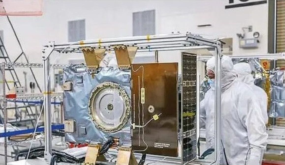
One of the most significant recent developments in this evolving paradigm is the establishment of a joint research laboratory dedicated to Unmanned Aerial Vehicles (UAVs) and satellite technology. This project aligns with the shared foreign policy priority of both nations to unlock the full potential of their strategic partnership. For candidates monitoring news for today's competitive examinations, understanding the depth of this partnership is essential. This collaboration is not an isolated event but a continuation of a long history of scientific cooperation, including joint work in basic sciences funded by the Department of Science and Technology (DST) and the Russian Science Foundation (RSF). This laboratory represents a shift from traditional buyer-seller dynamics toward a collaborative research and development model, which is a major theme in modern international relations.
For a more detailed understanding of this subject, candidates can refer to other materials available on the Atharva Examwise daily GK update portal, where analyses of various international agreements are presented.
Background of the Joint UAV and Satellite Research Laboratory
The establishment of the India-Russia Joint Research Laboratory focused on UAVs and satellite systems represents a pioneering leap in the fields of space and defense technology. The core objective of this laboratory is to develop an advanced technological framework that can enhance the speed, accuracy, and efficiency of border security, surveillance operations, and disaster management protocols. By integrating the vast amounts of data generated by satellite networks and unmanned platforms, this laboratory seeks to augment real-time decision-making capabilities in both defense and civilian sectors. This collaborative framework promises direct benefits not only for the defense apparatus but also for critical sectors such as agriculture, meteorology, and disaster relief management.
The establishment of this laboratory comes at a critical juncture when India is actively seeking to enhance its technological self-reliance, reduce dependence on external data providers, and secure its long borders against increasingly sophisticated asymmetric threats. This initiative reflects a broader trend in Indian defense policy toward the indigenization of technology and reducing reliance on foreign suppliers for critical components and data. By co-developing these technologies with a trusted partner, India can accelerate its development timelines while maintaining a high level of control over the resulting intellectual property and data.
In this context, for detailed official documents and press releases, the official website of the Ministry of External Affairs, Government of India, can be observed, which provides authentic information as external sources.
Technical Convergence: Integration of Satellite and Drone Data
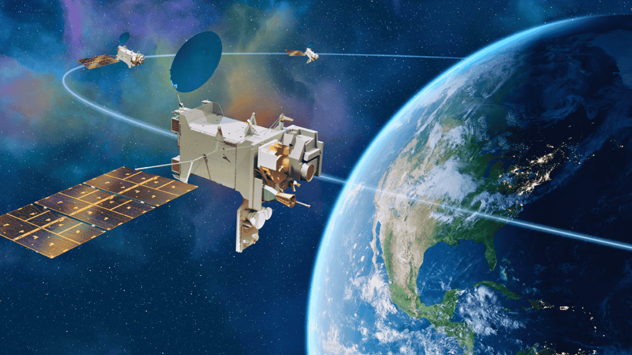
One of the fundamental challenges in modern remote sensing and reconnaissance is the balance between coverage area and temporal resolution (the frequency of data acquisition over time). Satellites provide unparalleled wide-area coverage, enabling the mapping of entire regions or cross-border movements. However, orbital mechanics and revisit rates often mean that satellite imagery cannot provide real-time updates or continuous live monitoring of localized events. In contrast, Unmanned Aerial Vehicles (UAVs) excel at providing high-resolution, live, close-up data streams and continuous surveillance over specific targets. However, drones are limited by their operational range and endurance.
The joint laboratory addresses this operational duality by creating a fused technical architecture where satellite networks and drone systems work in tandem. When large-scale satellite sweeps identify anomalies or areas of concern, automated drone systems can be directed to verify and monitor the target in real-time. This dynamic integration ensures a continuous flow of actionable, detailed intelligence that significantly accelerates the decision-making process for field commanders and emergency responders alike.
The table below illustrates the complementary nature of these two platforms and the operational benefits of their integration:
| Feature | Satellite Surveillance | UAV (Drone) Surveillance | Benefit of Integrated System |
|---|---|---|---|
| Area Coverage | Wide-area monitoring at global or regional levels. | Localized and focused on specific targets. | Comprehensive tracking from macro to micro levels possible. |
| Resolution | Limited by distance and atmospheric interference; medium to high. | Extremely high resolution; precise close-up imaging capability. | Multi-level resolution enabling precise target identification. |
| Real-time Updates | Hindered by orbital return times and revisit rates. | Ability to provide continuous, live feed during operation. | Continuous monitoring automatically triggered by wide-area satellite signals. |
| Operational Flexibility | Based on fixed orbital paths or pre-determined passes. | Highly flexible; dynamic deployment possible based on need. | Rapid and dynamic deployment via automated orbital detection. |
Key Technologies of the Laboratory and Their Applications
The efficacy of this joint research laboratory depends on several advanced key technologies that will be co-developed and refined by Indian and Russian researchers. These technologies represent the cutting edge of modern sensing, automation, and data processing. It is crucial for candidates preparing for science and technology-focused exams to understand these.
AI-Based Image Analysis and Automated Processing
The massive volume of raw data generated by continuous satellite feeds and high-definition drone video can overwhelm human analysts and slow down their work. Artificial Intelligence (AI) based image analysis provides a solution by automating the processing of this visual data. Machine learning algorithms are trained to recognize patterns, detect unauthorized border activities, and identify subtle environmental changes. This automated system allows security agencies to move away from manual observation toward exception-based monitoring, where the system flags only suspicious events for human review. This technology applies not only to the defense sector but also holds significant potential in civilian sectors such as monitoring urban development, tracking deforestation, and assessing the impact of natural disasters.
Hyperspectral Cameras and Advanced Sensing
Standard cameras work by capturing visible light in red, green, and blue bands. In contrast, hyperspectral cameras divide the electromagnetic spectrum into hundreds of narrow, continuous bands, capturing information that is entirely invisible to the human eye. In a defense context, hyperspectral sensors can defeat traditional camouflage by identifying the unique spectral signatures of artificial materials compared to natural foliage. For civilian applications, these sensors provide detailed readings on soil composition, moisture levels, and plant health, identifying agricultural problems before they become visually apparent. The development of indigenous hyperspectral imaging capabilities is a significant step toward achieving technological sovereignty and reducing reliance on foreign sensors.
Automated Drone Systems and Operational Control
The laboratory will prioritize the development of automated drone systems capable of executing pre-programmed or dynamically updated flight paths without direct human control. These systems will eventually foster "swarming" capabilities, where multiple drones coordinate their movements to map large areas or conduct complex reconnaissance missions. Automation reduces human error, lowers operational costs, and ensures that surveillance networks can operate consistently even in communication-disrupted environments. This research aligns with global trends in drone technology, where autonomy and swarming are seen as the future of unmanned systems.
The following table summarizes the key technologies envisioned by the laboratory and their primary applications:
| Technology | Methodology | Primary Application |
|---|---|---|
| AI-Based Image Analysis | Automated identification of patterns, movements, and anomalies in massive datasets. | Rapid threat detection, security surveillance, crop disease mapping. |
| Hyperspectral Cameras | Capturing spectral data in hundreds of bands beyond visible light. | Identifying camouflaged military assets, analyzing soil and crop health. |
| Automated Drone Systems | Self-governing flight paths, coordinated swarming, and real-time data relay. | Continuous border surveillance, quick-response reconnaissance, disaster area mapping. |
Impact on National Security and Border Management
Securing vast and geographically diverse borders has been a persistent challenge for the Indian security apparatus. Traditional methods often rely on periodic patrolling or static ground sensors, which can leave gaps in coverage and fail to provide timely information. The systems being developed in the joint laboratory promise to transform border surveillance into a highly responsive and real-time exercise.
Under the new framework, suspicious illegal incursions or activities identified by wide-area satellite surveillance can be verified immediately. Drones can be deployed to precise coordinates, transmitting live video feeds directly to tactical command centers. This integrated approach can reduce response times from hours to just a few minutes, giving security forces a definitive operational advantage. This capability is of immense importance for monitoring difficult terrains such as high-altitude regions in the North and dense forested areas, where traditional surveillance remains arduous.
The impact of this technology extends beyond immediate border security. The ability to monitor vast areas in real-time and process data automatically provides a powerful tool for counter-terrorism operations, monitoring maritime boundaries, and ensuring the safety of critical infrastructure. It also enhances the country's ability to respond to non-traditional security threats such as illegal cross-border migration and smuggling.
To study such security dimensions from a competitive exam perspective, candidates can regularly read the section at Atharva Examwise UPSC Current Affairs.
Civilian Use in Agriculture and Disaster Management
While the defense implications of the joint laboratory are substantial, its civilian uses are equally transformative, particularly in the fields of agriculture and disaster management. India's agricultural sector is expected to benefit immensely from the application of precise, real-time spatial data. By combining satellite land-mapping with close-up hyperspectral drone analysis, farmers and agricultural officials can implement precision farming techniques on a large scale. This integrated data can pinpoint exactly which specific parts of a field require irrigation, fertilizer, or pest control measures. This targeted approach dramatically reduces input costs, conserves resources, and boosts overall agricultural yield.
In the field of disaster management, the laboratory's technologies will be critical in dealing with extreme weather events, floods, and earthquakes. Real-time imaging from integrated drone and satellite grids allows for rapid damage assessment, tracking of floodwaters, and providing precise directions to search and rescue teams. This capability directly aligns with the broader research goals highlighted by the Department of Science and Technology and the Russian Science Foundation regarding earth sciences and environmental monitoring.
The dual-use nature of these technologies is a key topic for students analyzing UPSC current affairs. It demonstrates how investment in defense and space research can yield significant benefits for the broader economy and society. The ability to apply advanced sensing and data processing technologies to civilian problems is a hallmark of a mature and sophisticated technological ecosystem.
Geopolitical Significance of Strategic Autonomy and Data Sovereignty
Perhaps the most strategic advantage of the joint laboratory for India lies in the realm of data sovereignty and strategic autonomy. In the contemporary geopolitical landscape, reliance on foreign-owned commercial satellites or external state agencies for sensitive geospatial intelligence involves substantial risks. During periods of high tension or conflict, foreign data providers may restrict access to their systems or degrade the quality of the data provided.
By co-developing these advanced surveillance laboratories and housing the processing infrastructure within national borders, India ensures complete control over its strategic and sensitive data. This reduces dependence on third-party nations and significantly strengthens India's strategic depth. Controlling the entire data chain—from sensor development to algorithm processing and data storage—is a cornerstone of modern defense strategy, ensuring that national security decisions are made based on uncompromised and reliable intelligence.
This quest for data sovereignty is a vital component of India's broader strategy of strategic autonomy. It allows the country to pursue its national interests without being subject to the influence or pressure of external actors. It also enhances the country's credibility as a regional power capable of ensuring its own security and contributing to regional stability.
Synergy with India’s Domestic Defense Ecosystem
The initiatives planned under the joint laboratory are strongly aligned with other major projects within India's domestic defense and aerospace ecosystem. For example, Hindustan Aeronautics Limited (HAL) is actively leading the 'Combat Air Teaming System' (CATS). This program involves a manned fighter aircraft acting as a 'mothership' that controls a network of swarming Unmanned Aerial Vehicles (UAVs) and Unmanned Combat Aerial Vehicles (UCAVs). Notable components of the CATS project include the 'CATS Infinity' drone, designed as a solar-powered high-altitude drone with an endurance of up to three months to function as an atmospheric satellite.
The advanced imaging systems, automated targeting algorithms, and hyperspectral reconnaissance methods being developed in the India-Russia joint laboratory will have direct overlap and applications for systems like CATS Infinity. Furthermore, parallel research by the Defense Research and Development Organization (DRDO) in areas like Integrated Drone Detection and Interdiction Systems complements the offensive and surveillance drone technologies being explored in the joint lab, creating a comprehensive network of drone capabilities for the armed forces.
The table below outlines some key projects and capabilities in India's drone and space ecosystem that share technical synergy with the joint lab's research:
| Project / System | Developing Agency / Partner | Primary Capability and Focus |
|---|---|---|
| Combat Air Teaming System (CATS) | HAL, NAL, DRDO, Newspace | Manned-unmanned teaming, autonomous swarm drones. |
| Infinity Drone | Newspace Research & Technologies | Solar-powered high-altitude platform (Atmospheric Satellite). |
| CATS Warrior | HAL | Autonomous combat drone with swarming launch capabilities. |
| Integrated Drone Detection System | DRDO | Detection and neutralization of unauthorized or hostile drones. |
| S-400 Sudarshan | Russia (Supplied to India) | Advanced long-range air defense and missile system. |
This integration of research efforts across various agencies and programs is a crucial factor in maximizing the return on investment and accelerating technological development. It also reflects a shift toward a more integrated and collaborative approach within the Indian defense research establishment.
India-Russia Comprehensive Scientific Research Framework
Within the broader scope of scientific research cooperation, the joint laboratory project falls under a larger collaborative framework between India's Department of Science and Technology (DST) and the Russian Science Foundation (RSF). Under the DST-RSF collaboration, active proposals have been invited to fund joint research projects in diverse areas of basic and applied sciences. Each funded project can receive substantial annual funding to support scientific exchange and laboratory development.
The primary areas designated for research under this collaboration highlight deep alignment between the two countries on several high-technology fronts. These areas include:
New Materials: Research into advanced materials for aerospace and defense manufacturing.
Clean Energy: Sustainable energy systems and green technologies.
Smart Transport and Telecommunications: Next-generation telecommunications and autonomous transport systems.
Artificial Intelligence: Machine learning algorithms for complex data analysis.
Earth Sciences: Earthquake monitoring and oceanography applications.
The joint laboratory's focus on AI and satellite technology directly matches several of these priority areas, demonstrating the strategic coherence of the cooperation. It also suggests that the applications of the research conducted in the lab could extend beyond the immediate goals of border security and disaster management.
Key Facts and Exam-Relevant Data
For candidates preparing for competitive exams, the following points summarize the key factual data regarding this development:
The joint research laboratory has been established through a collaborative agreement between India and the Russian Federation to advance UAV and satellite technologies.
The 23rd India-Russia Annual Summit highlighted the 25th anniversary of the declaration on strategic partnership, which reinforced high-technology cooperation.
Key technologies being developed include AI-based image analysis, hyperspectral imaging systems, and automated drone control platforms.
The laboratory aims to reduce the response time for border security incidents from hours to just a few minutes through real-time data fusion.
Civilian applications primarily focus on precision agriculture and disaster management networks.
The Department of Science and Technology (DST) and the Russian Science Foundation (RSF) maintain active funding for joint research proposals equivalent to $100,000 per project per year in respective national currencies.
This initiative supports India's broader goals of achieving data sovereignty and strategic autonomy in geospatial intelligence.
Why this matters for your exam preparation
For candidates preparing for the Civil Services Examination and other competitive exams, this development holds immense importance across several papers of the syllabus. In General Studies Paper II (International Relations), it provides a concrete case study of the resilient and evolving nature of the India-Russia Special and Privileged Strategic Partnership amidst a changing global environment. It demonstrates how the relationship is moving beyond buyer-seller dynamics toward co-development in high-technology sectors.
In General Studies Paper III (Science and Technology, and Internal Security), it highlights the critical shift toward technological indigenization, data sovereignty, and dual-use aerospace platforms. Candidates should understand the mechanism of fused remote sensing, the application of AI in surveillance, and how such technologies translate into strategic autonomy. Analyzing the link between military R&D and agricultural benefits or disaster relief protocols helps candidates construct multi-dimensional answers that demonstrate a nuanced understanding of governance and development. For a more detailed analysis of defense cooperation, candidates can study other defense articles on the Atharva Examwise current news portal or stay connected with competitive exam news today for continuous coverage.