The global geopolitical landscape of 2026 stands at a turning point where wars are fought not just with missiles and bombs, but with invisible electromagnetic waves. As of March 17, 2026, the ongoing conflict in the Middle East—specifically 'Operation Epic Fury' launched by the U.S. and Israel—has ushered in a new era of Electronic Warfare (EW).
The large-scale use of GPS jamming and spoofing in this conflict has turned critical trade routes, such as the Strait of Hormuz, into a 'digital fog.' In this special Daily GK Update by Atharva Examwise, we will provide a detailed analysis of the technical, tactical, and economic aspects of this technology, which are vital for UPSC and other competitive examinations.
Background of Electronic Warfare: Operation Epic Fury and the 2026 Crisis
Launched on February 28, 2026, by the U.S. and Israel against Iran, 'Operation Epic Fury' has posed an unprecedented challenge to global maritime security. Within just 24 hours of the operation's commencement, nearly 1,100 ships in the Gulf region reported severe interference with GPS and Automatic Identification Systems (AIS). By March 7, 2026, this number escalated to over 1,650, representing a 55% increase from the previous week.
This interference is not limited to military objectives; it has also engulfed civil aviation and commercial shipping. Near the coasts of the UAE and Qatar, ship locations are being displayed incorrectly on digital maps, significantly increasing the risk of collisions. This situation is no longer just a regional conflict but a grave threat to global energy security and supply chains.
GNSS Functionality and Sensitivity
To understand GPS jamming and spoofing, one must first understand the mechanics of the Global Navigation Satellite System (GNSS). Systems like GPS rely on a network of satellites positioned approximately 20,200 km above the Earth. These satellites continuously transmit radio signals containing PNT services: Positioning, Navigation, and Timing.
The Physics of Signal Weakness
Because these signals travel the vast distance of 20,000 km to reach Earth, their signal strength becomes extremely weak. By the time a GPS signal reaches the surface, it is often weaker than the background radio noise. Exploiting this vulnerability, hostile nations or hackers can disrupt these signals using low-power jammers.
| Feature | GPS Jamming | GPS Spoofing |
|---|---|---|
| Nature | Signal Obstruction (Denial of Service) | Signal Deception (Fraud) |
| Mechanism | Sending 'noise' on the same frequency to drown out the real signal. | Transmitting fake data that mimics the real signal. |
| Objective | To show 'Signal Loss' so the receiver stops working. | To make the receiver believe it is in a different location. |
| Threat Level | Easily detectable. | More dangerous and stealthy; difficult to detect. |
| Cost | Very low cost (equipment available for $20). | Requires high technical expertise and expensive equipment. |
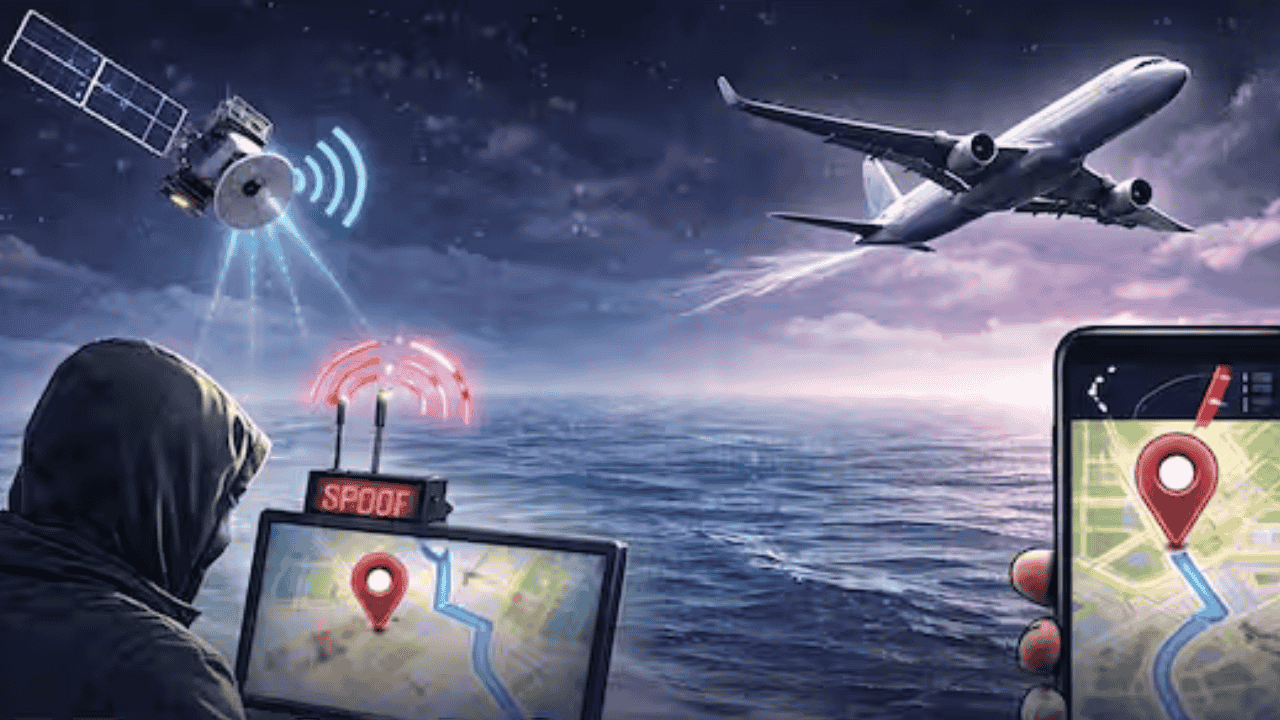
GPS Jamming: The Silent Destroyer of Navigation
GPS Jamming is a technique where a terrestrial device emits high-power radio frequency signals that 'overpower' the weak signals coming from satellites. These jammers primarily operate on the L1 and L2 frequency bands. When a ship or aircraft receiver enters the jammer's range, it fails to 'lock' onto legitimate satellite data, resulting in "No Signal" or "GPS Signal Lost" messages.
In combat, jamming is mainly used to disrupt the guidance of drones and guided missiles. However, the collateral damage includes the paralysis of civilian transport systems. In the 2026 conflict, tankers passing through the Strait of Hormuz have had to slow down or rely on alternative navigation methods due to jamming.
GPS Spoofing: An Invisible and Lethal Weapon
Spoofing is a far more sophisticated and 'insidious' attack than jamming. Here, the attacker uses a radio transmitter that perfectly mimics a legitimate GPS signal but injects false coordinates. The receiver believes it is getting valid information from a satellite and continues to function normally, but it is actually displaying the wrong location to the crew.
Dangerous Consequences of Spoofing:
Displacement: During the 2026 crisis, ships in the Strait of Hormuz were suddenly shown to be at an airport or inside mainland Iran while they were actually at sea.
Time Manipulation: GPS is used for precise timing in financial transactions and power grids. Manipulating timestamps through spoofing can lead to financial fraud.
Theft of Resources: Pirates can use spoofing to divert cargo ships from safe routes into insecure areas where they can be hijacked.
Middle East 2026: Statistical Analysis of the Maritime Crisis
The Strait of Hormuz handles approximately 20% of global oil trade and a massive portion of LNG exports. The impact of Operation Epic Fury has nearly paralyzed this route.
Events (March 2026): Data and Impact
Daily Traffic: Dropped from the normal 70-80 transits to fewer than 10.
GPS Disruptions: Over 600 GNSS disruption incidents recorded within 24 hours.
Affected Vessels: More than 1,650 ships faced electronic interference.
Insurance Premiums: Massive increase in war-risk insurance rates; insurance withdrawn from some sectors.
According to the maritime intelligence firm 'Windward,' ship AIS signals are now appearing in 'zig-zag' patterns or imaginary circles, clearly indicating GPS manipulation. Many ships have turned off their AIS systems to avoid detection, a practice known as 'going dark.'
Impact on Aviation and DGCA Vigilance
The effects of GPS interference are not confined to the sea. According to IATA, incidents of GPS signal loss in aircraft increased by 220% between 2021 and 2024. During the 2026 conflict, flights at Dubai International Airport had to be suspended due to drone-related incidents.
In India, the Directorate General of Civil Aviation (DGCA) has formed a special committee to monitor GNSS spoofing in Indian airspace. An Indian Air Force C-130J aircraft carrying relief material to Myanmar also encountered spoofing, forcing pilots to rely on the alternative Inertial Navigation System (INS).
India's Strategic Response: NavIC and Pralay Missile
Dependence on GPS has long been a security risk for India. During the 1999 Kargil War, the U.S. denied India GPS data for critical areas. In this context, India developed its indigenous system, NavIC (Navigation with Indian Constellation).
Features and Significance of NavIC:
Regional System: Consists of 7 satellites covering India and an area of 1,500 km around it.
Dual Frequency: NavIC uses both L5 and S-bands, making it more resistant to jamming.
Strategic Autonomy: In war, India will not have to rely on foreign systems. Its effectiveness was already proven during Operation Sindhoor.
Pralay Missile: India’s new 'Pralay' missile uses a 'Ring Laser Gyro-based INS' integrated with NavIC. This makes it completely immune to external GPS jamming.
Countermeasures Against Electronic Interference
Global regulatory bodies like the IMO, ICAO, and ITU have urged member states to take five key steps:
Multi-Constellation Receivers: Ships and aircraft should use GPS (USA), Galileo (Europe), GLONASS (Russia), and NavIC (India) simultaneously.
Signal Authentication: Features like Galileo’s OS-NMA allow the receiver to verify that the signal is actually coming from a satellite.
Sensor Fusion: GPS data should be cross-referenced with Radar, Magnetometers, and Inertial Measurement Units (IMU) to detect anomalies.
Anti-Jamming Antennas (CRPA): 'Controlled Reception Pattern Antennas' can identify the direction of a jamming signal and 'null' or block it.
Traditional Navigation Training: Crews should remain trained in traditional methods like 'Dead Reckoning' and celestial navigation.
Fast Facts for UPSC and Competitive Exams
Operation Epic Fury (2026): Military operation by the U.S. and Israel against Iran.
Strait of Hormuz: The world's most important oil chokepoint, located between Oman and Iran.
GNSS Altitude: Approximately 20,200 km (Medium Earth Orbit - MEO).
Budapest Convention: The first international treaty on cybercrime (India is not a signatory).
CERT-In: India’s national nodal agency for dealing with cybersecurity threats.
Why this matters for your exam preparation
From the perspective of UPSC and other competitive exams, this topic is critical as it bridges GS Paper-3 (Science and Technology), Security, and International Relations (GS Paper-2).
Science and Technology: Questions can be asked on the functioning and limitations of navigation systems (GPS, NavIC, Galileo). Satellite orbits and frequency bands (L1, L2, S-band) are vital for the Prelims.
Internal and Global Security: 'Electronic Warfare' and 'Cyber-Physical Attacks' are now part of modern security challenges. Questions on the impact of GPS jamming on India's security and possible solutions are expected in the Mains.
Geopolitics: Freedom of Navigation in areas like the Strait of Hormuz and the Red Sea is a pillar of international trade and diplomacy.
Strategic Autonomy: India’s steps toward self-reliance (e.g., NavIC and Pralay missile) are significant examples of the 'Atmanirbhar Bharat' campaign in the defense sector.
Stay updated with Atharva Examwise. For more detailed notes and practice questions from previous years related to this topic, visit the study materials section of our website.