
UPSC Current Affairs Daily GK Update: World's Highest Motorable Road, Himalayan Ecology, and Biodiversity Hotspots | Atharva Examwise Current News
High-Altitude Infrastructure and Strategic Road Engineering in the Himalayas
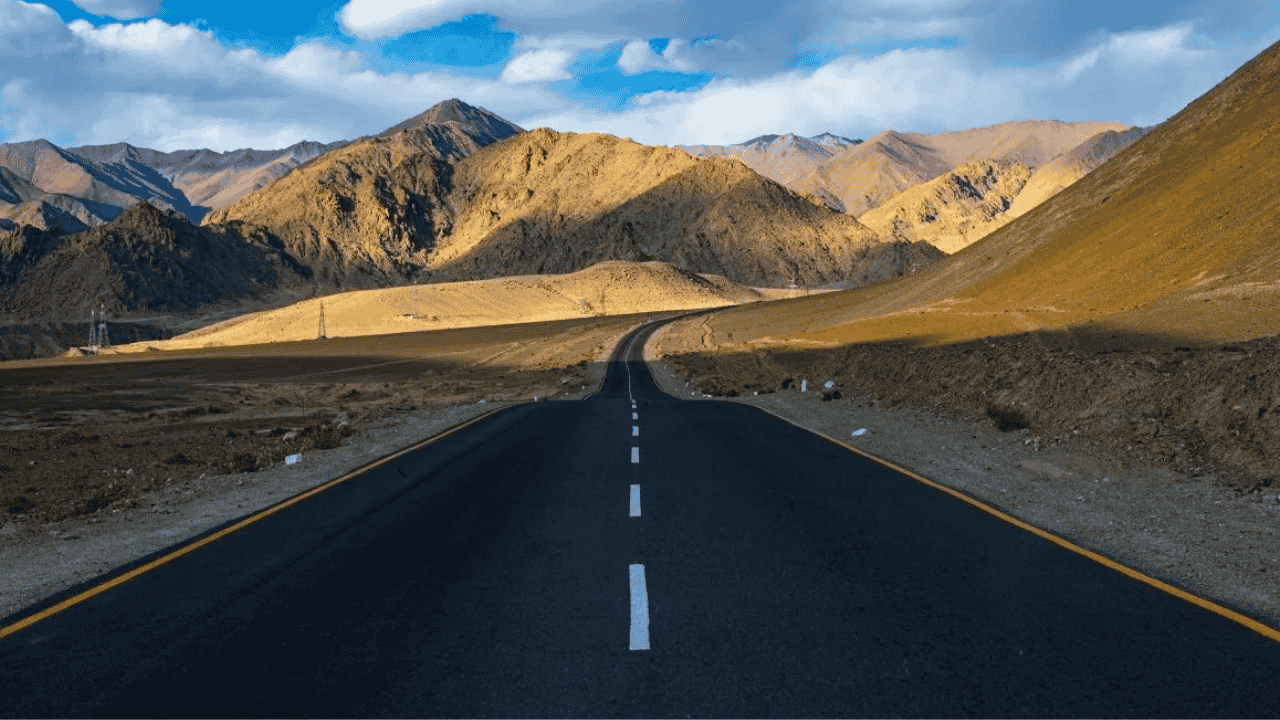
The geostrategic landscape of Eastern Ladakh has undergone a structural transformation driven by pioneering high-altitude civil engineering achievements by the Border Roads Organisation (BRO) under Project HIMANK. The construction and tarmac black-topping of the 52-kilometer Chisumle-Demchok road through Umling La Pass, situated at an altitude of 19,024 feet with specific crest road sections reaching up to 19,300 feet, represents a major milestone in national border infrastructure development. Officially certified by the Guinness World Records in November 2021, this tarmac pass surpassed the previous global record held by the Uturuncu Volcano track in Bolivia at 18,953 feet. Building on this operational momentum, Project HIMANK established a subsequent benchmark with the construction of the Likaru-Mig La-Fukche road axis across Mig La Pass at an elevation of 19,400 feet above sea level.
The engineering execution across these high-altitude passes overcomes severe physiological and atmospheric constraints. Construction units operate in sub-zero environmental conditions where winter temperatures plummet to -40 degrees Celsius and atmospheric oxygen levels drop by nearly 50 percent relative to sea-level concentrations. Internal combustion engines experience severe power degradation due to reduced atmospheric pressure, while construction personnel require structured acclimatization protocols to mitigate High Altitude Pulmonary Edema (HAPE) and High Altitude Cerebral Edema (HACE).
| High-Altitude Infrastructure / Location | Altitude / Elevation | Constructing Agency / Alignment | Strategic & Geomorphological Significance |
|---|---|---|---|
| Mig La Pass Road | 19,400 feet (5,913 m) | BRO / Project HIMANK (Likaru-Mig La-Fukche) | Connects critical border posts near Fukche; holds the record for the world's highest motorable road. |
| Umling La Pass Road | 19,024–19,300 feet (5,799 m) | BRO / Project HIMANK (Chisumle-Demchok) | Connects Chisumle and Demchok in Eastern Ladakh; recipient of official Guinness World Record certification. |
| Uturuncu Volcano Road (Bolivia) | 18,953 feet (5,777 m) | Civil Infrastructure / Unpaved Track | Former record holder for high-altitude motorable access. |
| Siachen Glacier Military Base | 17,700 feet (5,395 m) | Indian Armed Forces Defense Axis | High-altitude military sector; lower in elevation than both Umling La and Mig La passes. |
| Everest South Base Camp (Nepal) | 17,598 feet (5,364 m) | Non-motorable Trekking Route | International alpine base camp situated below the elevation of Ladakh's tarmac roads. |
| Khardung La Pass | 17,582 feet (5,359 m) | BRO / Project HIMANK | Historic arterial gateway connecting Leh to the Shyok and Nubra Valleys. |
The strategic implications of these roads extend across both national defense and regional socio-economic spheres. Geopolitically, establishing direct vehicular access to border settlements like Demchok and Fukche along the Line of Actual Control (LAC) enhances rapid force-projection capabilities and military logistics. Socio-economically, year-round tarmac connectivity integrates isolated pastoral communities into broader regional markets, reduces transit times to Leh, and promotes high-altitude adventure tourism. Detailed coverage of border infrastructure developments is routinely updated on the Atharva Examwise Current News Portal, with primary official notifications accessible through the PIB Press Release Directory.
Key Facts: High-Altitude Infrastructure Data
World Record Elevation: Umling La Pass stands at 19,024 feet (5,799 m), with peak tarmac segments reaching 19,300 feet, making it higher than both Mount Everest South Base Camp (17,598 feet) and North Base Camp (16,900 feet).
Project HIMANK Role: Constructed under BRO's Project HIMANK, the 52 km Chisumle-Demchok road officially received the Guinness World Record in November 2021.
Subsequent Milestone: The Mig La Pass road alignment (19,400 feet) further expanded India's border network along the Likaru-Mig La-Fukche axis.
Extreme Operating Conditions: Construction and maintenance personnel face temperature dips to -40°C and a 50 percent reduction in ambient oxygen levels.
Physical Geography and Alpine Ecosystems of the Indian Himalayas
The Indian Himalayan Region (IHR) forms the primary physical barrier and climatic regulator of the South Asian subcontinent. Geologically originated through the collision of the Indian Tectonic Plate with the Eurasian Plate during the Cenozoic Era, the terrain features severe vertical topography. India encompasses over 138 mountain peaks exceeding an altitude of 6,000 meters above mean sea level. This vertical distribution generates diverse micro-climatic zones ranging from tropical foothill valleys to alpine cold deserts in Ladakh, Lahaul-Spiti, and Upper Sikkim.
To support high-altitude operations, scientific research, and search-and-rescue capabilities, India established a network of premier mountaineering institutions. Institutions such as the Himalayan Mountaineering Institute (HMI) in Darjeeling, the Nehru Institute of Mountaineering (NIM) in Uttarkashi, and the Jawahar Institute of Mountaineering and Winter Sports (JIM&WS) in Pahalgam have collectively trained more certified mountaineers and high-altitude rescue specialists than any equivalent national system globally.
| Altitude Zone | Elevation Range | Prevailing Vegetation / Landscape | Key Ecological & Environmental Dynamics |
|---|---|---|---|
| Nival Zone | Above 5,000 meters | Permanent snowfield, glaciers, crustose lichens | Cryoturbation, severe freeze-thaw cycles, extreme solar radiation, non-vegetated terrain. |
| Alpine Zone | 3,500 to 5,000 meters | Alpine meadows (Bugyals), dwarf shrubs, mosses | Seasonal grazing grounds, high altitude permafrost, low biomass productivity. |
| Sub-Alpine Zone | 2,800 to 3,500 meters | Birch (Bhojpatra), Rhododendron, Silver Fir | Eco-tone transition zone, sensitive to thermal variations and timberline shifting. |
| Temperate Zone | 1,500 to 2,800 meters | Deodar, Oak, Maple, Blue Pine forests | Dense canopy cover, primary catchment area for Himalayan perennial rivers. |
| Subtropical Zone | Below 1,500 meters | Sal forests, mixed deciduous, bamboo thickets | High primary productivity, human settlement corridors, land-use conversion pressure. |
The extreme elevation gradient creates pronounced ecological zonation across Himalayan watersheds:
Atmospheric and Thermal Compression: As elevation increases, barometric pressure decreases, causing rapid adiabatic cooling and severe diurnal temperature fluctuations.
Permafrost and Soil Geomorphology: High-altitude soils suffer from low organic decomposition rates, leaving thin pedologic layers vulnerable to rain-induced slope failure and soil erosion.
Hydrological Dynamics: Himalayan glaciers serve as the headwater source for major river systems, including the Indus, Ganga, and Brahmaputra, controlling regional agricultural cycles across North India.
In-depth analytical modules on Himalayan geomorphology are available via the Atharva Examwise Geography Notes.
Key Facts: Physical Geography & Mountain Ecosystems
6,000-Meter Peaks: India hosts over 138 mountain peaks rising above 6,000 meters elevation, driving localized orographic weather patterns and glacial activity.
Global Mountaineering Hub: Indian mountaineering training centers lead globally in technical high-altitude survival, expedition leadership, and alpine rescue certifications.
Perennial Hydrology: Snowpack melt and glacial runoff from high Himalayan ranges sustain the base flow of primary South Asian river networks.
Biodiversity Hotspots and UNESCO Mixed World Heritage Sites
India’s mountain ecosystems function as significant repositories of biological diversity, providing habitat for over 15,000 plant species preserved across alpine, sub-alpine, and temperate forest zones. These floral communities underpin crucial ecosystem services, including headwater hydrology regulation, carbon sequestration, and slope stabilization across steep river catchments.
At the international level, Conservation International designates 36 global biodiversity hotspots characterized by extreme species endemics and severe habitat loss. India intersects four of these hotspots: the Himalayas, the Western Ghats, the Indo-Burma region, and Sundaland. Two of these—the Eastern Himalayas and the Western Ghats—are situated entirely or substantially within Indian territory.
| Region / Site Name | Conservation Status / Category | Biodiversity Characteristics | Key Endemic & Threatened Species |
|---|---|---|---|
| Eastern Himalayas | Global Biodiversity Hotspot | High vertical gradient, alpine meadows, temperate coniferous forests. | Red Panda (Ailurus fulgens), Snow Leopard (Panthera uncia), Orchidaceae endemics. |
| Western Ghats | Global Biodiversity Hotspot | Tropical evergreen forests, Montane Shola-grassland complex. | Lion-tailed Macaque, Nilgiri Tahr, endemic amphibian assemblages. |
| Khangchendzonga National Park | UNESCO Mixed World Heritage Site (2016) | Spans from 1,200 m to 8,586 m elevation; integrates natural and cultural criteria. | Himalayan Musk Deer, Tibetan Wolf, sacred Buddhist/Lepcha landscape features. |
A central milestone in Indian ecological conservation is Khangchendzonga National Park (KNP) in Sikkim, inscribed in 2016 as India's only 'Mixed World Heritage Site' under UNESCO's World Heritage Convention. The mixed site designation requires fulfilling both natural and cultural heritage criteria:
Natural Criteria (vii and x): KNP contains dramatic topography ranging from subtropical ecosystems to the summit of Mount Khangchendzonga (8,586 meters, the third-highest peak on Earth). It encompasses major glaciers such as the Zemu Glacier, high-altitude tarns, and critical habitats for endangered alpine fauna.
Cultural Criteria (iii and vi): The park protects the sacred geography of Mayel Lyang for the indigenous Lepcha people and the cultural landscape of Beyul (sacred hidden realm) in Tibetan Buddhism. Local landscape features—including mountains, caves, and rivers—remain actively integrated into living religious traditions and sacred geography.
Candidates can explore comprehensive environmental profiles through the Atharva Examwise Environment Section, while international heritage datasheets can be referenced at the UNESCO World Heritage Centre Portal.
Key Facts: Biodiversity & Heritage Data
Mixed World Heritage Status: Khangchendzonga National Park is India's sole UNESCO Mixed World Heritage Site, satisfying Natural Criteria (vii, x) and Cultural Criteria (iii, vi).
Global Hotspots: India houses significant portions of 4 global biodiversity hotspots, with the Eastern Himalayas and Western Ghats situated primarily within the country.
Botanical Diversity: Mountain forest ecosystems in India shelter over 15,000 plant species, representing a vital genetic reservoir for medicinal and ecological resources.
Why This Matters for Your Exam Preparation
Understanding high-altitude road infrastructure, physical geomorphology, and mountain biodiversity is essential for candidates preparing for competitive examinations such as the UPSC Civil Services Examination (CSE). This topic bridges physical geography, environmental ecology, international agreements, and national security.
UPSC General Studies Paper Alignment
UPSC Prelims (GS Paper I - Geography & Environment):
Location-Based & Physical Mapping: Questions on high-altitude passes (Umling La, Mig La, Khardung La), mountain ranges, and cold desert geomorphology.
Ecology & Conservation: Direct questions regarding UNESCO World Heritage criteria, global biodiversity hotspots, and protected area networks (e.g., KNP).
UPSC Mains (GS Paper I - Physical Geography):
Salient Features of World's Physical Geography: Analysis of mountain-building processes, vertical climate zonation, vegetation shifts, and glacial retreat in high-altitude zones.
UPSC Mains (GS Paper III - Security & Environment):
Border Area Infrastructure: Strategic evaluation of dual-use transport networks (civilian transport vs. defense mobilization) built by BRO along international boundaries.
Environmental Impact & Conservation: Balancing border security infrastructure projects with ecological preservation inside fragile biodiversity hotspots.
Exam Strategy & Answer Writing Integration
Factual Accuracy in Prelims: Distinguish between Umling La (19,024 ft) and Mig La (19,400 ft) to correctly answer statement-based questions regarding global elevation records.
Interdisciplinary Mains Synthesis: When addressing questions on border development, connect engineering achievements (Project HIMANK) with socio-economic inclusion of border tribes and defense preparedness along the LAC.
Structured Ecological Framing: Cite Khangchendzonga National Park as a case study for 'Mixed Heritage' management, demonstrating how indigenous cultural protection aligns with biological conservation.
For customized mock tests and answer-writing practice, visit the Atharva Examwise Practice Series.