The Panpatia Col Trek, located in the Garhwal Himalayas of Uttarakhand and often referred to as the 'Crown of Uttarakhand,' is currently a focal point of discussion. This interest stems not only from its adventurous allure but also from the state government's new tourism and mountaineering policies. In this special report dated March 27, 2026, we analyze the geographical and historical aspects of this grueling trek, the recently announced '83 Himalayan Peaks' policy, and the provisions of the Union Budget 2026-27 aimed at making India a global adventure tourism hub. For UPSC and other competitive exam aspirants, this article serves as a comprehensive source for understanding the interconnections between physical geography, Indian art and culture, and environmental policy.
Panpatia Col: Geographical Location and Geomorphic Structure
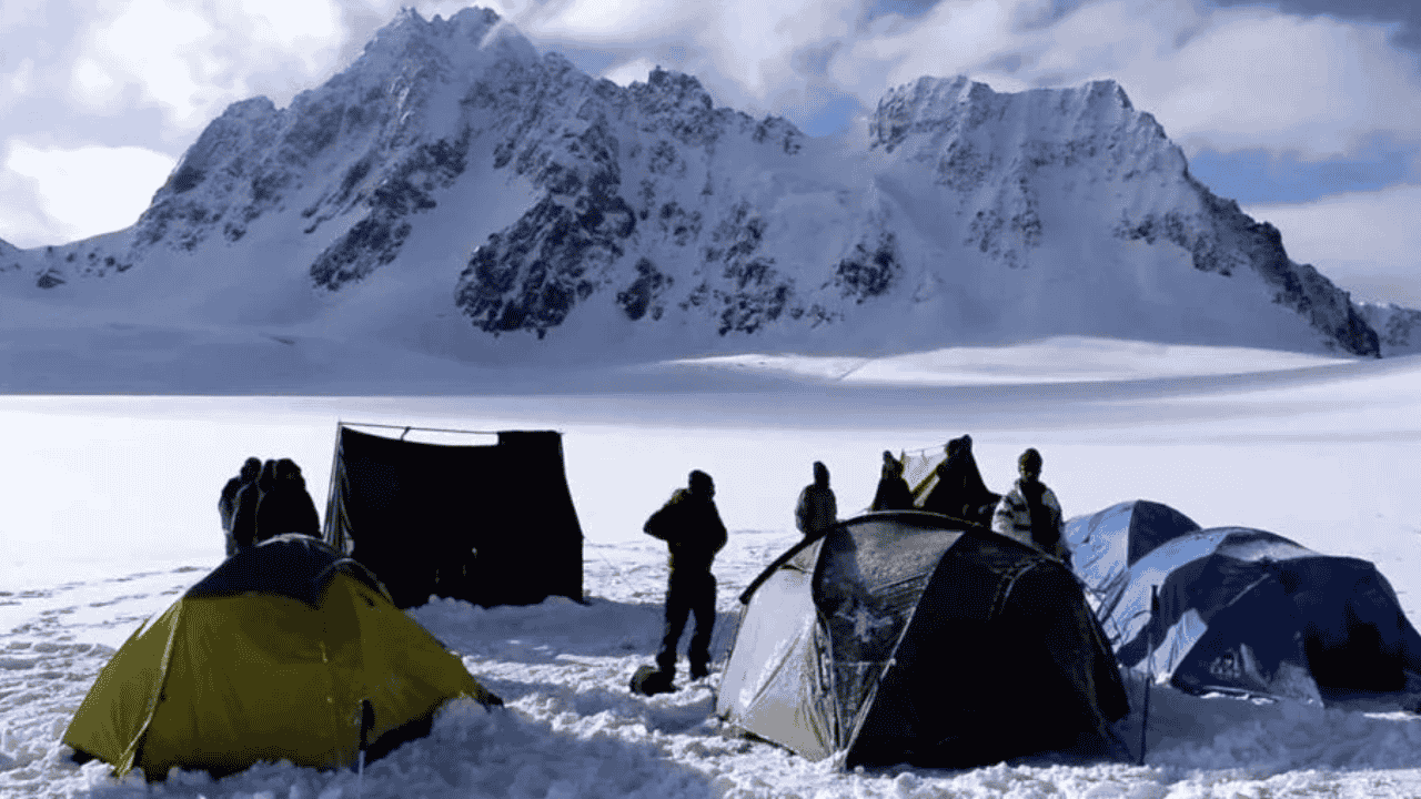
The Panpatia Col trek is situated in the high Himalayan region of the Chamoli district, directly connecting Badrinath (the abode of Lord Vishnu) to Kedarnath (the abode of Lord Shiva). Located at an altitude of approximately 17,257 feet (5,260 meters), this pass lies between two unnamed peaks (5,500m+). Its geographical complexity is so profound that it is nicknamed the 'Labyrinth of the Himalayas.'
Key Geographical Features and Statistics
The topography of the Panpatia region is extremely challenging, featuring massive glaciers, deep snowfields, and dangerous moraines. The following table summarizes its key characteristics:
| Feature | Description |
|---|---|
| Maximum Altitude | 5,260 meters (17,257 feet) |
| Total Distance | Approximately 76 to 82 kilometers |
| Category | Strenuous / Technical Mountaineering |
| Major Rivers | Alaknanda, Khiron Ganga, Madmaheshwar Ganga |
| Visible Peaks | Chaukhamba, Neelkanth, Balakun, Hathi Parbat, Nanda Devi |
| Major Glaciers | Panpatia Glacier, Parvati Glacier |
The trek typically begins from Mana Village or Hanuman Chatti near Badrinath and proceeds through the Khiron Valley. A standout feature is the 'Panpatia Snowfield', a stunning 7-km long plateau completely covered in snow. Geologically, this area exhibits remnants of the Pleistocene Epoch ice age and serves as a primary water source for the Alaknanda basin.
Historical Exploration: From Shipton to Martin Moran
The history of the Panpatia route is a saga of human struggle to solve Himalayan mysteries. For decades, this route existed only in legends.
Early Exploration and Failures
1934: Famous British explorers Eric Shipton and H.W. Tilman attempted to find the "easy legendary route" between Badrinath and Kedarnath. They failed to find the pass and ended up on an arduous path via Satopanth Col, getting trapped in the dense bamboo forests of the Gondharpangi valley.
1984: Two Indian mountaineers went missing while searching for this route, highlighting its dangerous nature.
1997: Renowned Himalayan explorer Harish Kapadia attempted the trek but had to retreat due to technical obstacles at the Panpatia Icefall.
1999: Anindya Mukherjee and Sundar Singh reached Panpatia Col but could not complete the crossing due to illness within the team.
The Historic Success of 2000
The mystery of Panpatia Col was finally unraveled in 2000 by a team led by British mountaineer Martin Moran. Moran's team discovered a route near Neelkanth Peak, successfully negotiated the Panpatia Icefall, and exited towards Kedarnath. This was a milestone in exploration history as it proved the physical existence of the 'legendary route' mentioned in ancient texts. In 2007, a Bengali team led by Tapan Pandit and Debabrata Mukherjee recorded the first successful Indian crossing.
Mythological and Cultural Significance: A Spiritual Bridge
Panpatia Col is more than a geographical pass; it is a spiritual bridge between the two most important sects of Hinduism—Vaishnavism and Shaivism.
The Legend of the Priest
According to local folklore, a priest in ancient times used to perform puja at both Kedarnath and Badrinath temples daily. Since the pedestrian distance between these two sites is hundreds of kilometers, doing so in a single day is humanly impossible. It is believed that Lord Shiva, pleased by the priest's devotion, created a secret short path through the mountains. However, the path was later turned into a 'Labyrinth' to prevent misuse by common people.
Interconnection of Major Pilgrimage Sites
Badrinath Temple: Established by Adi Shankaracharya in the 9th century, it is one of the Char Dhams, dedicated to Lord Vishnu.
Kedarnath Temple: One of the 12 Jyotirlingas, dedicated to Lord Shiva.
Madmaheshwar: The Panpatia trek often concludes near the Madmaheshwar temple, one of the 'Panch Kedar' temples believed to have been built by the Pandavas.
Administrative Reforms: Uttarakhand Mountaineering Policy 2026
The year 2026 has emerged as a revolutionary year for Uttarakhand’s tourism. Under the leadership of Chief Minister Pushkar Singh Dhami, the state has taken major steps to democratize adventure tourism.
Opening of 83 Himalayan Peaks
On February 3, 2026, the Uttarakhand government opened 83 major peaks in the Garhwal and Kumaon divisions for mountaineering. These range from 5,700 meters to 7,756 meters in height.
| Major Peaks | Altitude (m) | Significance |
|---|---|---|
| Kamet | 7,756 | Technically extremely challenging |
| Nanda Devi East | 7,434 | Strategic and ecological importance |
| Chaukhamba Group | 7,138 | Prominent peak of the Panpatia region |
| Neelkanth | 6,596 | Known as the 'Queen of Garhwal' |
| Shivling | 6,543 | World-famous peak |
Key Highlights of the New Policy
Fee Waiver for Indian Mountaineers: Indian citizens no longer need to pay peak permit fees, camping fees, or environmental fees for these 83 notified peaks.
Simplified Rules for Foreigners: Additional state-level levies have been abolished; they now only need to pay the fees prescribed by the Indian Mountaineering Foundation (IMF).
UKMPS Portal: Permissions can now be obtained transparently and quickly via the 'Uttarakhand Mountaineering Permission System' online portal.
Local Employment: This initiative aims to generate jobs for guides, porters, and homestay operators in border villages, helping to curb migration (Palyan).
UPSC Physical Geography Analysis: Glacial Landforms
For the UPSC Mains GS Paper-1 (Geography), the Panpatia region serves as an excellent case study for Glacial Processes.
Glacial Erosional Landforms
Glaciers create various shapes through Plucking and Abrasion:
Cirque: Bowl-shaped depressions at the top of high mountains. When the ice melts, they become 'Tarn Lakes', such as Sujal Sarovar (4,750m).
Arete and Horn: When multiple cirques erode a mountain from different sides, they create pyramidal peaks (Horns) like Neelkanth and narrow, sharp ridges called Aretes.
U-Shaped Valley: The Khiron Ganga valley is a classic example where the heavy weight of a glacier has widened and deepened a river's V-shaped valley into a U-shape.
Glacial Depositional Landforms
As glaciers melt, they deposit debris known as Till:
Moraine: Massive piles of Lateral Moraine and Terminal Moraine are found along the Panpatia route, indicating the historical extent of the glacier.
Glacial Snout: The point where a glacier ends and melting begins. The 'Snout Camp' near Panpatia Icefall represents this feature.
Climate Change and Himalayan Ecology: A Grave Challenge
Himalayan glaciers, known as the 'Third Pole', are melting rapidly due to global warming. This is highly relevant for UPSC GS Paper-3 (Environment).
Glacial Retreat
Studies show that the Gangotri glacier has retreated by more than 1,500 meters since 1935. The Panpatia region faces similar threats, leading to:
GLOF Risk: Glacial Lake Outburst Floods pose a severe threat to downstream infrastructure and life.
Reduced Albedo Effect: As ice disappears, dark rocks are exposed, absorbing more solar radiation and accelerating the melting process (Positive Feedback Loop).
Water Security: Glaciers act as 'Water Towers' for millions. Their retreat threatens the perennial flow of rivers like the Alaknanda and Bhagirathi, affecting agriculture and hydropower.
Strategic Importance and 'Vibrant Village' Program
The Panpatia trek passes through areas close to the Line of Actual Control (LAC) with Tibet (China), giving it strategic weight.
Vibrant Village Program: Villages like Mana are being developed as 'India's First Village' to stop border population migration and strengthen security infrastructure.
Aerial Connectivity: On March 26, 2026, a new flight service began between Dehradun and Pithoragarh.
Ropeway Projects: Ropeways from Sonprayag to Kedarnath (12.9 km) and Govindghat to Hemkund Sahib (12.4 km) will make travel safer and easier.
Budget 2026-27 and the Future of Adventure Tourism
In the Union Budget 2026-27, Finance Minister Nirmala Sitharaman announced several key measures for hilly states:
Ecologically Sustainable Mountain Trails: Proposals to develop world-class trekking trails in Uttarakhand, Himachal Pradesh, and J&K.
National Destination Digital Knowledge Grid: A digital grid to catalog cultural and spiritual sites, creating jobs for local researchers.
Guide Training Scheme: A pilot project to train 10,000 guides at 20 prominent tourist destinations.
Note: Ecologists warn that large-scale human activity in high Himalayan zones increases environmental pressure, necessitating strict adherence to 'Leave No Trace' principles.
Why this matters for your Exam Preparation
GS Paper-1 (Geography & Culture): Direct questions on Glacial Geomorphology (Cirques, Aretes) and the cultural contribution of Adi Shankaracharya.
GS Paper-2 (Governance & IR): Use the UKMPS portal as an example of E-Governance; the Vibrant Village Program for Border Management.
GS Paper-3 (Environment & Economy): GLOF risks and the economics of adventure tourism as a tool for sustainable development.
Prelims: Locations of the 83 opened peaks and specific provisions of Budget 2026-27.
Stay connected with Atharva Examwise for detailed study materials and daily updates.