Bharat Forecasting System (BFS): India’s Historic Leap in Meteorology
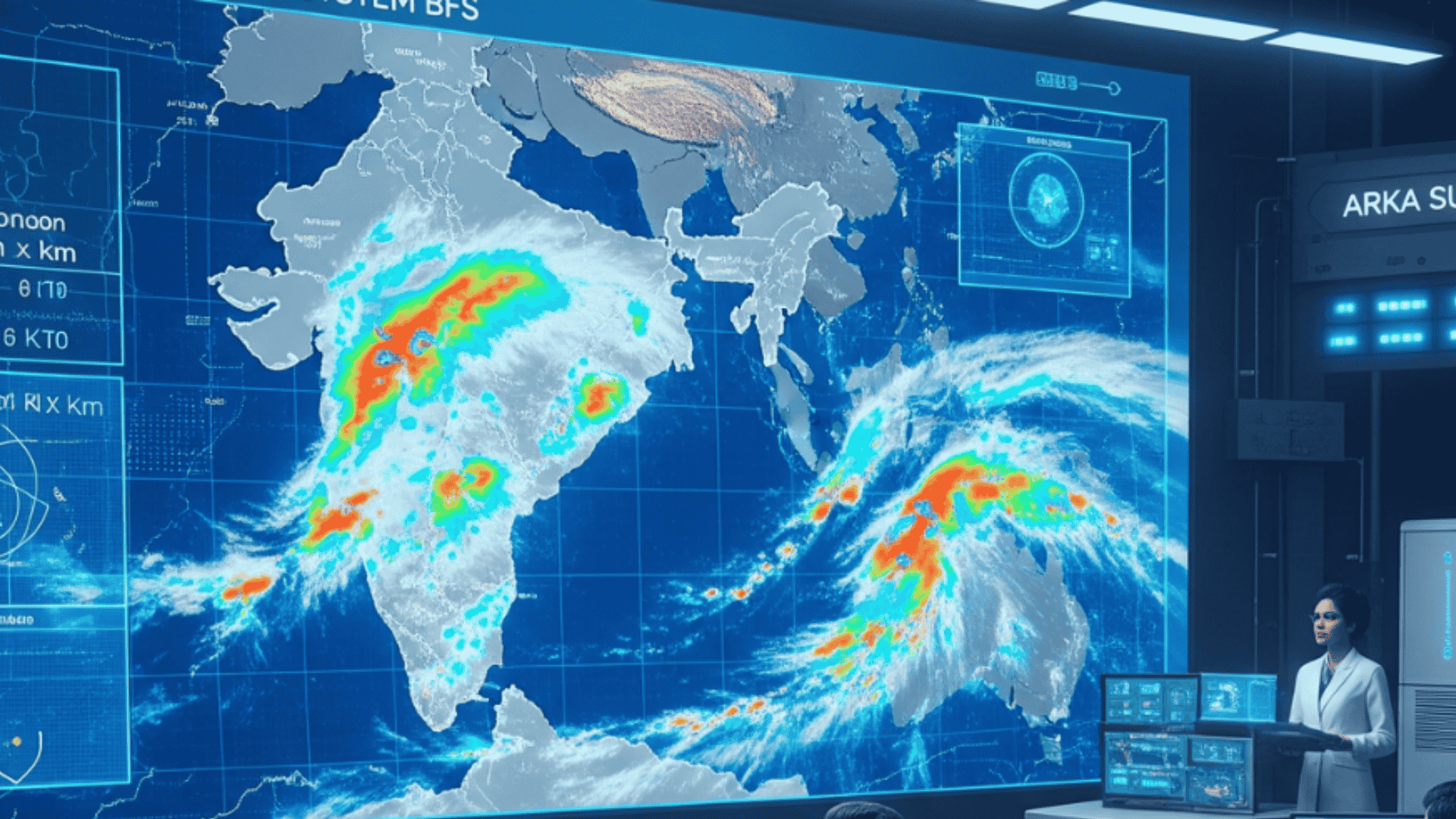
On 26 May 2025, India launched the Bharat Forecasting System (BFS), a state-of-the-art numerical weather prediction model developed by the Indian Institute of Tropical Meteorology (IITM), Pune. With a spatial resolution of 6 km, BFS makes India the first country capable of providing hyper-local weather forecasts. Compared to the systems of the US, UK, and Europe (9–14 km resolution), this is far more advanced. This innovation will bring revolutionary changes in agriculture, disaster management, and climate resilience.
Key Features of BFS
World’s Highest Resolution:
BFS operates on a 6 km × 6 km grid, enabling weather forecasts at the village level. Previously, India’s 12 km grid system provided a single forecast for 4–5 villages, but now BFS will deliver separate forecasts for each village.
Use of AI and Machine Learning:
For the first time, AI/ML algorithms have been used for short-term (2 hours) and long-term forecasts, increasing the accuracy of extreme rainfall predictions by 30% and monsoon core zone accuracy by up to 64%.
Power of Arka Supercomputer:
Powered by the Arka supercomputer with a capacity of 11.77 petaflops (33 petabytes storage), BFS can now process data in just 4 hours instead of the previous 10 hours.
Open Access – Global Collaboration:
BFS outputs are open to meteorologists worldwide, fostering global research.
Benefits of BFS for India
Agriculture: Farmers will receive precise information about rainfall, temperature, and storms, reducing crop losses.
Disaster Management: Early warnings for floods, cyclones, and heavy rainfall will enable better preparedness.
Urban Planning: Accurate forecasts for pollution and heatwaves will reduce health risks.
Defence and Aviation: Improved assessment of the direction and intensity of sea storms will make air and naval operations safer.
Technological Advancements
Triangular Cubic Octahedral Grid Model:
This grid structure is more effective for tropical weather forecasting compared to traditional linear models.
Doppler Radar Network:
With 40 Doppler radars (to be expanded to 100 in the future), BFS receives real-time atmospheric data, enabling “nowcasting” (forecasts up to 2 hours ahead).
Global Comparison
| Country/Model | Resolution |
|---|---|
| India (BFS) | 6 km |
| USA, Europe, UK | 9–14 km |
With a 6 km resolution, India has become a global leader, enabling precise monitoring of microclimates.
Why This Matters for Your Exam Preparation
GS-III (Science & Technology):
BFS is an example of India’s indigenous technological advancement (Make in India).
Focus on AI/ML in meteorology and supercomputing (Arka’s 11.77 petaflops capacity).
GS-I (Geography):
Link BFS to climate change adaptation strategies and disaster resilience.
GS-III (Disaster Management):
Prepare a case study on how BFS enables better early warning systems for floods/cyclones.
UPSC Prelims:
Questions may be asked about 6 km resolution, IITM Pune, and the functioning of Doppler radar.
Related Articles on Atharva Examwise:
Monsoon Forecast Models: UPSC Guide
Science & Technology Current Affairs
Why this matters for your exam preparation
This topic is extremely important for UPSC Prelims, Mains (GS-III: Science & Technology, Disaster Management, Agriculture), and other competitive exams.
It covers India’s technological achievements, indigenous scientific innovation, disaster management, agriculture, and the multi-layered aspects related to climate change.
Be sure to include this topic in your answers with data, examples, and analysis.
For regular current affairs and exam-focused analysis, visit Atharva Examwise Current Affairs.