
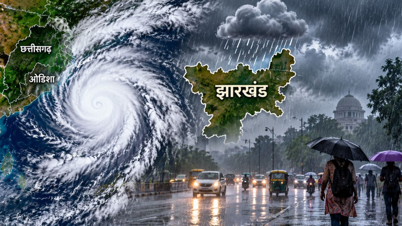
UPSC Current Affairs November 3, 2026: Cyclone Murasu Landfall, Western Disturbance & Daily GK Update | Atharva Examwise Current News
Executive Summary: Competitive Exam News Today
In the domain of Indian Physical Geography, Climatology, and Disaster Management (General Studies Paper-I and Paper-III), the synoptic weather configuration across the Indian subcontinent during the first week of November 2026 presents a classic study in contrasting post-monsoon atmospheric dynamics. Within a span of less than seven days following the landfall of Very Severe Cyclonic Storm Arnab on October 28, 2026, the North Indian Ocean basin has generated a second consecutive cyclonic system—Severe Cyclonic Storm Murasu—over the Bay of Bengal. While Cyclone Arnab struck between the Andhra Pradesh and Yanam coasts from Bapatla to Visakhapatnam with sustained winds of 110–115 kmph and gusts reaching 140 kmph, Cyclone Murasu is tracking west-northwestwards toward the southern coast of Andhra Pradesh. The system is projected to cross the eastern littoral zone between Nellore and Narsapur between midnight on Monday (November 2) and the early hours of Tuesday (November 3), packing sustained gale-force winds of 100–110 kmph and gusts reaching 120 kmph.
Simultaneously, the subcontinental weather pattern reveals a sharp latitudinal divergence that forms a crucial component of this daily GK update. While the eastern seaboard manages compound cyclonic hazards through large-scale evacuations and inter-state relief deployments, the extra-tropical Himalayan belt is experiencing an approaching Western Disturbance capable of triggering rainfall and high-altitude snowfall across Jammu & Kashmir and Uttarakhand over a 48-hour window. Conversely, following the passage of these transient disturbances, the establishment of dry northerly continental winds across the Indo-Gangetic plains is forecast to bring clear, rain-free skies from Dhanteras through Diwali while depressing nocturnal surface temperatures to 16°C against daytime highs of 32°C—creating the precise boundary-layer thermal inversion conditions that exacerbate post-Diwali particulate pollution across Delhi-NCR. For civil services aspirants following Atharva Examwise Current News, this triad of meteorological phenomena links core NCERT Geography Foundation concepts directly to contemporary disaster governance.
Synoptic Analysis of Severe Cyclonic Storm Murasu
Cyclone Murasu originated as a low-pressure area over the Andaman Sea and consolidated into a depression late on Saturday (October 31) before intensifying into a Severe Cyclonic Storm (SCS) over the West-Central and adjoining Southwest Bay of Bengal during the active Northeast Monsoon phase. By 04:30 UTC on November 2, 2026, the Regional Specialized Meteorological Centre (RSMC) at the India Meteorological Department (IMD) recorded the storm center near latitude $13.9^\circ\text{N}$ and longitude $81.8^\circ\text{E}$—situated approximately 200 km east-northeast of Chennai, 210 km east-southeast of Nellore, and 260 km southeast of Ongole—with a central barometric pressure of 998 hPa and a west-northwestward translational velocity of 25 kmph (13 knots). Across coastal Andhra Pradesh, preliminary squally winds of 80–90 kmph gusting to 100 kmph commenced on November 2 before escalating to full landfall intensity.
Trajectory, Landfall Mechanics, and Rapid Post-Landfall Decay
A critical analytical takeaway from the synoptic tracking of Cyclone Murasu is the stark contrast between its pre-landfall destructive potential and its rapid post-landfall dissipation. As the system approaches the coast between Nellore and Narsapur in Andhra Pradesh, its interaction with warm coastal waters sustains surface wind speeds of 100–110 kmph (gusting to 120 kmph), generating a significant coastal storm surge capable of inundating low-lying littoral tracts and sustaining gale-force rainfall across affected districts until the morning of November 4. The outer convective rainbands of the system span a wide geographical arc, triggering heavy to very heavy precipitation across Coastal Andhra Pradesh, Rayalaseema, Tamil Nadu, Puducherry, Karaikal, Odisha, Telangana, and Chhattisgarh, alongside secondary moisture incursion into Maharashtra, Kerala, and Mahe, whereas West Bengal (Kolkata) remains largely insulated with only light, sporadic rain more than 700 km away from the primary strike zone.
However, meteorological models indicate that immediately following landfall, Cyclone Murasu will undergo accelerated structural weakening, with surface conditions beginning to normalize within 24 hours. Forecasts from RSMC New Delhi project the system to downgrade from a Severe Cyclonic Storm to a Cyclonic Storm by 00:00 UTC on November 3 and further weaken into a Deep Depression by 12:00 UTC on the same day. This rapid decay is driven by two reinforcing physical mechanisms: first, the abrupt termination of oceanic latent heat flux and the surge in surface roughness (frictional drag) over peninsular land; and second, the synoptic capture of the vortex by an approaching upper-level mid-latitude trough, which forces the remnant low-pressure system to recurve northward and north-northeastward while increasing vertical wind shear across the storm core.
IMD Classification of Cyclonic Disturbances and Warning Protocol
For competitive exam aspirants, understanding the exact quantitative thresholds used by the India Meteorological Department (IMD) Cyclone SOP to categorize cyclonic disturbances over the North Indian Ocean ($45^\circ\text{E}$ to $100^\circ\text{E}$) is essential for tackling statement-based questions in UPSC Prelims. Unlike the Saffir-Simpson Hurricane Wind Scale (which relies on 1-minute sustained winds), the IMD scale utilizes 3-minute maximum sustained surface winds alongside Dvorak Technique T-numbers (ranging from T1.0 to T8.0 at 0.5 intervals) and central pressure deficiency.
| Cyclonic Disturbance Category | Sustained Wind Speed (kmph) | Sustained Wind Speed (Knots) | Central Pressure Deficit (hPa) | Dvorak Scale (T-Number) | Operational Benchmark / Expected Coastal Impact |
|---|---|---|---|---|---|
| Low Pressure Area (LPA) | $< 31\text{ kmph}$ | $< 17\text{ kt}$ | $1.0\text{ hPa}$ | T 1.0 | Minimal marine disturbance; routine monitoring. |
| Depression (D) | $31\text{–}49\text{ kmph}$ | $17\text{–}27\text{ kt}$ | $1.0\text{–}3.0\text{ hPa}$ | T 1.5 | Moderate to rough seas; fishermen advised not to venture into open seas; triggers Stage-1 Pre-Cyclone Watch. |
| Deep Depression (DD) | $50\text{–}61\text{ kmph}$ | $28\text{–}33\text{ kt}$ | $3.0\text{–}4.5\text{ hPa}$ | T 2.0 | Very rough seas ($4.0\text{–}6.0\text{ m}$ waves); minor damage to loose and unsecured structures. |
| Cyclonic Storm (CS) | $62\text{–}88\text{ kmph}$ | $34\text{–}47\text{ kt}$ | $6.1\text{–}10.0\text{ hPa}$ | T 2.5–3.0 | Threshold for official WMO/ESCAP Storm Naming; high seas ($6.0\text{–}9.0\text{ m}$ waves); damage to thatched huts and tree branches. |
| Severe Cyclonic Storm (SCS) | $89\text{–}117\text{ kmph}$ | $48\text{–}63\text{ kt}$ | $15.0\text{ hPa}$ | T 3.5 | Cyclone Murasu ($100\text{–}110\text{ kmph}$); very high seas ($9.0\text{–}14.0\text{ m}$); widespread crop damage, flooded roads, disruption to rail and power lines. |
| Very Severe Cyclonic Storm (VSCS) | $118\text{–}166\text{ kmph}$ | $64\text{–}89\text{ kt}$ | $20.9\text{–}29.4\text{ hPa}$ | T 4.0–4.5 | Cyclone Arnab ($110\text{–}115\text{ kmph}$ at landfall; peak VSCS intensity); phenomenal seas ($> 14.0\text{ m}$); secondary telecom and microwave tower misalignment at $85\text{ kt}$ ($158\text{ kmph}$). |
| Extremely Severe Cyclonic Storm (ESCS) | $167\text{–}221\text{ kmph}$ | $90\text{–}119\text{ kt}$ | $40.2\text{–}65.6\text{ hPa}$ | T 5.0–6.0 | Phenomenal seas; structural destruction of radio and microwave towers at $100\text{ kt}$ ($186\text{ kmph}$). |
| Super Cyclonic Storm (SuCS) | $\ge 222\text{ kmph}$ | $\ge 120\text{ kt}$ | $\ge 80.0\text{ hPa}$ | $\ge$ T 6.5 | 1999 Odisha Super Cyclone ($140\text{ kt}$ / $912\text{ hPa}$); catastrophic devastation, satellite communication dishes damaged above $135\text{ kt}$ ($251\text{ kmph}$). |
To operationalize these wind thresholds for civil administration, the IMD executes a standardized four-stage colour-coded warning mechanism across Indian coasts. The sequence begins with Stage 1, a Pre-Cyclone Watch (carrying no colour code or early notice), which is issued 72 hours in advance when a depression forms over the North Indian Ocean with the potential to impact the Indian coastline. As the disturbance matures, Stage 2 triggers a Cyclone Alert (Yellow Message, signifying "Be Updated") at least 48 hours prior to the expected onset of adverse weather in coastal areas. Subsequently, Stage 3 escalates to a Cyclone Warning (Orange Message, signifying "Be Prepared") at least 24 hours in advance, wherein forecasters pinpoint the exact coastal districts at risk and discuss the projected landfall location. Finally, Stage 4 comprises the Post-Landfall Outlook and Landfall Alert (Red Message, denoting "Take Action / Danger"), issued at least 12 hours before landfall. Ahead of Cyclone Murasu's arrival, the IMD issued this Stage-4 Red Message for five districts in coastal Andhra Pradesh and adjoining northern Tamil Nadu, mandating emergency sheltering, total suspension of port, marine, rail, and road transit, and active deployment of disaster response forces.
Science and Culture of Cyclone Naming: Why "Murasu"?
A recurring theme in UPSC current affairs and state civil services examinations involves the institutional nomenclature of tropical cyclones. The name 'Murasu' was contributed by India to the comprehensive tropical cyclone naming registry adopted in April 2020 by the WMO/ESCAP Panel on Tropical Cyclones (PTC). Etymologically derived from Tamil, Murasu refers to a traditional war drum or ceremonial percussion instrument historically utilized across southern India to broadcast royal proclamations and urgent public announcements. The semantic alignment between an ancient acoustic warning instrument and a modern meteorological hazard warning system underscores the cultural rationale behind India's nomination.
Institutional Architecture of the WMO/ESCAP Naming Registry
Formal naming of tropical cyclones in the North Indian Ocean commenced in September 2004 with eight founding member nations, expanding in 2020 to encompass 13 member countries bordering the Bay of Bengal and the Arabian Sea: Bangladesh, India, Iran, Maldives, Myanmar, Oman, Pakistan, Qatar, Saudi Arabia, Sri Lanka, Thailand, the United Arab Emirates, and Yemen. Each member nation submitted 13 names, generating a master matrix of 169 predetermined names maintained by RSMC New Delhi.
Under the Press Information Bureau (PIB) WMO/ESCAP Naming Guidelines, any proposed name must satisfy strict technical criteria: it must be short (maximum eight letters), easy to pronounce, neutral toward political, religious, and cultural sensibilities, devoid of offensive connotations in any regional language, and never repeated once assigned (effectively retiring every used name in the North Indian Ocean). Crucially, the country that suggests a name is not the country struck by the storm; names are assigned strictly sequentially down alphabetical country columns as soon as any cyclonic disturbance over the Arabian Sea or Bay of Bengal attains a sustained 3-minute wind speed of 34 knots (62 kmph).
| Sequential Order | Cyclone Name | Contributing Country | Language & Etymology / Meaning | Operational Status (Nov 2026) |
|---|---|---|---|---|
| Previous Storm | Arnab (Pronounced Ornab) | Bangladesh | Bengali word meaning "Ocean". | Made landfall on Oct 28, 2026, between Bapatla and Visakhapatnam as a VSCS ($110\text{–}115\text{ kmph}$, gusts $140\text{ kmph}$). |
| Current Storm | Murasu | India | Tamil word meaning "War Drum" or traditional percussion instrument. | Making landfall Nov 2–3, 2026, between Nellore and Narsapur as an SCS ($100\text{–}110\text{ kmph}$, gusts $120\text{ kmph}$). |
| Next in Roster | Akvan | Iran | Persian mythological demon / spirit (Akvan Div). | Next sequential designation for the North Indian Ocean basin. |
| Subsequent Queue | Kaani, Ngamann, Sail | Maldives, Myanmar, Oman | Sequential rotational list Step 3 after Iran. | Reserved in the WMO/ESCAP List-2 column. |
India's 13 contributions to the 2020 registry—compiled by the IMD from public submissions and regional meteorological centers—reflect pan-Indian linguistic diversity: Gati, Tej, Murasu, Aag, Vyom, Jhar, Probaho, Neer, Prabhanjan, Ghurni, Ambud, Jaladhi, and Vega. With Gati (2020), Tej (2023), and now Murasu (November 2026) utilized, India's next contribution in the subsequent rotational column will be Aag.
Thermodynamics of Cyclogenesis and Coastal Vulnerability
The physical mechanism summarized in the news report—"a cyclone forms from oceanic heat, yet its hazard reaches deep inland"—represents a foundational concept in Atharva Examwise Study Material for UPSC Geography. A mature tropical cyclone operates as a massive, self-sustaining Carnot heat engine driven by the transfer of thermal energy from the tropical ocean to the atmosphere.
Pre-Requisite Boundary Conditions and the Latent Heat Cycle
For a tropical depression over the Bay of Bengal to intensify into a Severe Cyclonic Storm like Murasu, six classical atmospheric and oceanographic boundary conditions must align simultaneously. First, the ocean must supply abundant thermal energy across a deep mixed layer (top $50\text{–}60\text{ m}$) with Sea Surface Temperatures (SST) exceeding $26.5^\circ\text{C}$, paired with high mid-tropospheric relative humidity ($500\text{–}700\text{ hPa}$) to prevent dry-air entrainment from eroding convective updrafts. Second, atmospheric instability (a steep environmental lapse rate) must coincide with a pre-existing low-level disturbance, as tropical cyclones cannot generate spontaneously and require a weakly organized cyclonic vortex with sizable spin and low-level inflow. Third, the system must develop at least $5^\circ$ latitude away from the Equator so that the Coriolis force ($f = 2\Omega \sin\phi$) imparts planetary vorticity to deflect converging winds into a counter-clockwise spiral in the Northern Hemisphere, while low vertical wind shear—specifically a wind velocity change of less than $10\text{ m/s}$ ($20\text{ knots}$) between the lower ($1.5\text{ km}$) and upper troposphere ($12\text{ km}$)—preserves the vertical integrity of the storm's thermal core.
As warm, humid air converges toward the low-pressure center, it ascends vigorously within the eyewall—a ring of towering cumulonimbus clouds surrounding the cloud-free, calm central eye ($10\text{–}50\text{ km}$ in diameter), where wind speeds drop rapidly. Outside the eyewall, the band of maximum winds spans between $10\text{ and }150\text{ km}$, with overall cyclone diameters over the North Indian Ocean averaging $300\text{–}600\text{ km}$. As the ascending water vapor cools and condenses into liquid droplets and rain within the eyewall, it releases massive quantities of latent heat of condensation ($L_v \approx 2.5 \times 10^6\text{ J/kg}$) into the upper troposphere. Roughly 3% of this released thermal energy is converted directly into kinetic energy to maintain the horizontal wind circulation, and a single mature cyclone releases total energy equivalent to 100 hydrogen bombs. Once the vortex crosses the coastline, it is severed from its oceanic moisture and heat reservoir, causing the central pressure to fill and wind speeds to decay; nevertheless, orographic and frictional convergence continues to dump torrential rain inland while onshore gale winds pile seawater into destructive coastal storm surges.
Why does the Bay of Bengal generate four times more cyclones than the Arabian Sea and bear the brunt of back-to-back October–November storms like Arnab and Murasu? Beyond higher average SSTs, the Bay of Bengal receives massive freshwater influx from the Ganga, Brahmaputra, Irrawaddy, Godavari, and Krishna river systems. This low-salinity freshwater forms a stable, buoyant surface lens that inhibits vertical mixing with cooler subsurface water, preserving high surface temperatures even after a preceding cyclone passes. Furthermore, the Bay's semi-enclosed concave geometry funnels storm surges directly into shallow, low-lying deltaic plains—a vulnerability demonstrated during Cyclone Arnab, when marine assessments warned of seawater advancing $180\text{ to }300\text{ meters}$ inland across villages in Kakinada district. With a coastline of $8,041\text{ km}$, the Indian subcontinent is exposed to nearly 10% of the world's tropical cyclones (experiencing 5 to 6 cyclones annually, of which 2 to 3 become severe). According to the IMD's Climatology of Cyclone Hazard Prone Districts, out of 100 cyclone-prone districts in India (74 touching the coast and 26 within 100 km inland), all 12 "Very Highly Prone" districts are concentrated exclusively along the eastern seaboard: Nellore, Krishna, and East Godavari in Andhra Pradesh, Yanam in Puducherry, Balasore, Bhadrak, Kendrapara, and Jagatsinghpur in Odisha, and South/North 24 Parganas, Medinipur, and Kolkata in West Bengal.
Disaster Federalism and East Coast Operational Response
The operational response to Cyclone Murasu demonstrates the maturation of India's disaster management architecture from post-disaster relief to pre-landfall zero-casualty mitigation, alongside a deeper structural trend: cooperative disaster federalism under the Disaster Management Act, 2005. Because Cyclone Murasu struck less than a week after Cyclone Arnab had already saturated coastal soils, flooded homes with seawater, uprooted trees, and forced the cancellation of over 50 trains across 11 Andhra Pradesh districts, state administrations faced a classic compound hazard scenario where the threshold for flash flooding and power grid failure was substantially lowered.
To mitigate this compound risk, eastern littoral states executed coordinated multi-agency interventions across state borders. Building upon its globally recognized community-based disaster preparedness model, Odisha preemptively evacuated more than 1.60 lakh (160,000) residents from vulnerable coastal and low-lying settlements into multipurpose cyclone shelters prior to landfall. Simultaneously, demonstrating horizontal federalism, the Government of Tamil Nadu proactively deployed 90 National Disaster Response Force (NDRF) personnel and 500 state electricity board technicians to Andhra Pradesh to accelerate post-landfall power grid restoration and rescue operations—even as Tamil Nadu braced for heavy district-wide rainfall and Chennai grappled with severe urban waterlogging that necessitated precautionary school closures. Within Andhra Pradesh, aviation authorities cancelled 19 commercial flights across three airports, established 24-hour district control rooms, and integrated the Mana Mitra digital helpline alongside the NDMA-IMD Common Alerting Protocol (CAP), Doppler Weather Radars, INSAT satellites, ocean buoys, Vessel Monitoring Systems (VMS), and Distress Alert Transmitters (DAT) provided by INCOIS to safeguard marine fishing communities.
Synoptic Contrasts: Western Disturbance and Post-Diwali Delhi-NCR Pollution
While tropical cyclogenesis dominates peninsular India, the northern half of the subcontinent exhibits two interconnected atmospheric developments highlighted in the daily weather bulletin: an approaching Western Disturbance over the Western Himalayas and an impending post-Diwali air quality crisis across the northern plains.
| Geographic Region | Dominant Synoptic System | Meteorological Parameters (Nov 3–6, 2026) | Primary Socio-Environmental Impact |
|---|---|---|---|
| Eastern Coast & Deccan Peninsula (AP, TN, Odisha, Telangana, Chhattisgarh, Maharashtra) | Severe Cyclonic Storm Murasu (Northeast Monsoon Vortex) | Sustained winds $100\text{–}110\text{ kmph}$ (gusts $120\text{ kmph}$); central pressure $998\text{ hPa}$; rapid decay post-landfall within 24 hours. | Coastal storm surge inundation, 19 flights cancelled in AP, Chennai school closures, 1.60 lakh evacuated in Odisha. |
| Western Himalayas (Jammu & Kashmir, Uttarakhand) | Western Disturbance (Extra-Tropical Westerly Wave) | Two-day precipitation window; orographic lifting of mid-latitude moisture over high mountain ranges. | Rainfall in valleys and fresh snowfall on higher Himalayan peaks; negligible rain impact by Dhanteras–Diwali. |
| Indo-Gangetic Plains & Delhi-NCR | Dry Northerly Continental Winds & Radiative Inversion | Daytime maximum temperature $32^\circ\text{C}$; nocturnal minimum dropping to $16^\circ\text{C}$; dry, clear skies over Diwali. | Sharp contraction of Planetary Boundary Layer (PBL) height at night, trapping aerosols and driving a post-Diwali pollution spike. |
Extra-Tropical Western Disturbances vs. Tropical Cyclones
Aspirants utilizing Atharva Examwise State PCS & UPSC Resources must clearly distinguish the approaching Himalayan system from Cyclone Murasu. Unlike tropical cyclones—which originate over warm tropical oceans, possess a warm core, lack frontal boundaries, derive energy from latent heat of condensation, and travel east-to-west in the trade-wind belt—Western Disturbances are extra-tropical (temperate) cyclonic storms originating over the Mediterranean Sea, Caspian Sea, and Black Sea. Embedded within the upper-tropospheric Subtropical Westerly Jet Stream (STWJ), these cold-core baroclinic systems travel eastward across Iran, Afghanistan, and Pakistan before colliding with the topographic barrier of the Western Himalayas. Over the next 48 hours, this disturbance is projected to induce light-to-moderate rain across Jammu & Kashmir and Uttarakhand and deposit fresh snowfall across higher Himalayan peaks, providing critical early-season soil moisture for Rabi crops (especially wheat and mustard) across northwestern India before clearing out entirely ahead of Dhanteras and Diwali.
Boundary-Layer Physics of the Post-Diwali Pollution Spike in Delhi-NCR
A nuanced second-order causal relationship links the Himalayan Western Disturbance and the east-coast cyclone to the projected deterioration of air quality in Delhi-NCR after Diwali. Once the Western Disturbance passes eastward across the Himalayas, the wake of the mid-latitude trough draws dry northerly and northwesterly continental winds down from the snow-covered mountains into the Indo-Gangetic Plains. Simultaneously, the deep low-pressure vortex of Cyclone Murasu over the eastern coast reinforces the pressure gradient pulling dry continental air southward across northern and central India. These dry katabatic and continental flows purge atmospheric moisture—guaranteeing clear, rain-free skies from Dhanteras through Diwali—while causing nocturnal minimum temperatures across the plains to plunge to $16^\circ\text{C}$ even as daytime maximum temperatures reach $32^\circ\text{C}$.
This $16^\circ\text{C}$ diurnal temperature range acts as a meteorological trap for urban pollutants through boundary-layer thermodynamics. Under clear, cloudless Diwali skies, the land surface rapidly radiates longwave infrared heat into space after sunset, chilling the ground to $16^\circ\text{C}$ and cooling the air layer immediately above it while a warmer air layer persists aloft from the $32^\circ\text{C}$ daytime heating. This reverses the normal tropospheric lapse rate, creating a stable nocturnal radiative temperature inversion lid that suppresses vertical convection. Consequently, the Planetary Boundary Layer (PBL)—or mixing height—contracts sharply at night, and once the initial northerly breeze subsides, the Ventilation Coefficient ($\text{Mixing Height} \times \text{Average Wind Speed}$) collapses. Particulate matter ($\text{PM}_{2.5}$ and $\text{PM}_{10}$), sulfur dioxide ($\text{SO}_2$), and nitrogen oxides ($\text{NO}_x$) emitted from vehicular exhaust, industrial clusters, agrarian biomass burning, and festive firecrackers become trapped within a shallow surface breathing zone, driving a severe post-Diwali pollution spike across Delhi-NCR.
Prelims Fact Sheet: Key Facts & Exam-Relevant Data
To facilitate rapid revision alongside Atharva Examwise Monthly Current Affairs MCQ PDFs, the following high-yield bullet points synthesize the key facts and exam-relevant data from today's competitive exam news today:
Cyclone Murasu Nomenclature: Named by India under the 2020 WMO/ESCAP Panel on Tropical Cyclones list; Murasu is a Tamil word meaning "War Drum" (traditional percussion instrument used for public proclamations).
Rotational Naming Queue: Murasu follows Cyclone Arnab (named by Bangladesh, meaning "Ocean" in Bengali, which struck Andhra Pradesh between Bapatla and Visakhapatnam on October 28, 2026, with sustained winds of $110\text{–}115\text{ kmph}$ and gusts of $140\text{ kmph}$) and will be succeeded by Cyclone Akvan (contributed by Iran).
Landfall Coordinates & Intensity: Crossing the southern Andhra Pradesh coast between Nellore and Narsapur (Nov 2 midnight – Nov 3 early morning) as a Severe Cyclonic Storm (SCS) with sustained winds of 100–110 kmph, gusts up to 120 kmph, and central pressure of 998 hPa (IMD SCS range: $48\text{–}63\text{ knots}$ or $89\text{–}117\text{ kmph}$).
WMO/ESCAP Panel Composition: Established in September 2004 and expanded in 2020 to 13 North Indian Ocean nations (Bangladesh, India, Iran, Maldives, Myanmar, Oman, Pakistan, Qatar, Saudi Arabia, Sri Lanka, Thailand, UAE, and Yemen), administering 169 non-repeating names ($13 \times 13$, max 8 letters each) through RSMC New Delhi once sustained winds reach 34 knots (62 kmph).
East Coast Disaster Response Metrics: Over 1.60 lakh citizens evacuated in Odisha; 90 NDRF personnel and 500 power workers deployed by Tamil Nadu to assist Andhra Pradesh; 19 flights cancelled across 3 Andhra Pradesh airports; Mana Mitra digital helplines activated.
IMD 12 Very Highly Prone Cyclone Districts: Out of 100 cyclone-prone districts in India, all 12 very highly prone districts lie on the East Coast—Nellore, Krishna, East Godavari (AP); Yanam (Puducherry); Balasore, Bhadrak, Kendrapara, Jagatsinghpur (Odisha); and South 24 Parganas, North 24 Parganas, Medinipur, Kolkata (West Bengal).
Northern India Synoptic Shift: An extra-tropical Western Disturbance brings a two-day spell of rain and high-altitude snow to Jammu & Kashmir and Uttarakhand, followed by dry northerly winds dropping plain night temperatures to $16^\circ\text{C}$ (daytime $32^\circ\text{C}$), ensuring clear weather for Diwali but exacerbating post-Diwali air pollution in Delhi-NCR.
Why this matters for your exam preparation
The convergence of Cyclone Murasu, the Himalayan Western Disturbance, and the Indo-Gangetic air quality transition directly intersects multiple syllabus pillars across the UPSC Civil Services Examination (Prelims and Mains), MPPSC, and other State Civil Services examinations. For UPSC Prelims (General Studies Paper-I – Physical & Indian Geography), the Commission regularly frames multi-statement questions testing the thermodynamic contrast between tropical and extra-tropical cyclones, the role of the Coriolis force and latent heat of condensation, and the institutional rules of the WMO/ESCAP naming convention. Aspirants must master the exact wind threshold at which a deep depression receives an official name (34 knots / 62 kmph), the non-repetition rule for North Indian Ocean cyclone names, and the sequential country roster (Bangladesh $\rightarrow$ India $\rightarrow$ Iran).
In UPSC Mains General Studies Paper-I (Important Geophysical Phenomena), analytical questions examining why the Bay of Bengal experiences a post-monsoon (October–November) secondary peak in severe cyclogenesis—and how upper-tropospheric westerly troughs cause post-landfall recurvature and rapid 24-hour decay—can be substantiated using the Arnab–Murasu back-to-back case study. Similarly, the interaction between dry northerly continental winds, $16^\circ\text{C}$ nocturnal radiative cooling, and thermal inversion provides a precise meteorological framework for answering Mains questions on winter smog formation in the Indo-Gangetic Plain. Finally, for UPSC Mains General Studies Paper-III (Disaster Management & Environment), the preemptive evacuation of 1.60 lakh citizens in Odisha, Andhra Pradesh's deployment of Mana Mitra digital helplines, and Tamil Nadu's inter-state dispatch of 90 NDRF personnel and 500 power technicians serve as contemporary empirical evidence of Sendai Framework for Disaster Risk Reduction (2015–2030) implementation and cooperative federalism under NDMA guidelines. Aspirants are encouraged to integrate these current affairs case studies with foundational modules on the Atharva Examwise NCERT & GS Portal to build high-scoring answers across all stages of civil services preparation.