
UPSC Current Affairs October 6, 2026: China-Afghanistan Wakhan Corridor Road and Strategic Implications for India | Atharva Examwise Current News and Daily GK Update
The geopolitical landscape of Central and South Asia has witnessed a structural shift following the formal completion and operational inauguration of a 121-kilometer motorable roadway traversing the Wakhan Corridor. Constructed over a two-year timeline at an estimated expenditure of 365 million Afghanis (approximately 5.5 million US dollars), this unpaved route connects the Broghil pass region in Afghanistan's northeastern Badakhshan province directly to the border of the Xinjiang Uyghur Autonomous Region of China.
This project establishes the first direct overland arterial link between Afghanistan and the People's Republic of China, bypassing traditional transit hubs and transforming an impassable mountain salient into an active conduit. For candidates analyzing competitive exam news today and tracking daily GK update modules, this infrastructure project marks a decisive realignment at the trijunction of Central Asia, South Asia, and China. This development carries security, cartographic, and economic implications for Indian foreign policy and continental defense, requiring detailed appraisal on platforms like Atharva Examwise Current Affairs.
Geopolitical Overview: Operationalization of the Wakhan Corridor Route
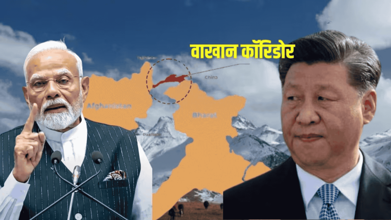
The Wakhan Corridor is a narrow geographic salient located within the Badakhshan province of northeastern Afghanistan. Hemmed in by the high-altitude topography of the Pamir, Karakoram, and Hindu Kush mountain ranges, this narrow strip of territory separates the Gorno-Badakhshan Autonomous Region of Tajikistan to the north from Pakistan-occupied Kashmir (specifically the Gilgit-Baltistan territory claimed by India) to the south, terminating eastward at the border of China's Xinjiang region.
The new 121-kilometer unpaved alignment terminates along the frontier near the Wakhjir Pass, an elevation point exceeding 4,900 meters. While the roadway remains unpaved and subject to severe winter closures that limit transit to seasonal windows, the establishment of functional vehicular mobility closes a historic geographical gap between Kabul and Beijing.
| Geostrategic Parameter | Project and Regional Specifics |
|---|---|
| Geographic Alignment | Broghil (Badakhshan Province, Afghanistan) to Xinjiang Border (China) |
| Total Road Length | 121 Kilometers (Unpaved, high-altitude motorable arterial track) |
| Project Expenditure | Approximately 365 Million Afghanis (~$5.5 Million USD) |
| Mountain Systems | Intersection of the Pamir Knot, Karakoram, and Hindu Kush ranges |
| Bordering Territories | Tajikistan (North), Xinjiang, China (East), Gilgit-Baltistan (PoK, South) |
| Indian Strategic Baseline | Proximate to Union Territory of Ladakh; 106 km claimed border with Afghanistan |
Historical Cartography: From the Great Game to Contemporary Frontiers
A thorough comprehension of this development for Atharva Examwise UPSC Preparation requires contextualizing the corridor within nineteenth-century imperial diplomacy. Historically, the Wakhan region operated as an essential branch of the ancient Silk Road, facilitating commercial, philosophical, and monastic interactions across Eurasia, with expeditions by figures such as Alexander the Great and Marco Polo navigating adjacent mountain corridors.
During the late nineteenth century, imperial rivalry between the British Empire and Tsarist Russia culminated in the "Great Game" for hegemony over Central Asia. Through the work of the Pamir Boundary Commission in 1895, British and Russian negotiators deliberately demarcated the Wakhan Corridor under Afghan sovereignty. The primary objective of this cartographic intervention was to create an impassable neutral buffer state, preventing the borders of the Tsarist Russian Empire from directly contacting the northern boundaries of British India.
Following the partition of the Indian subcontinent in 1947, Pakistan's military aggression and illegal occupation of the erstwhile princely state of Jammu and Kashmir (specifically the Gilgit Agency and Baltistan) severed India's direct ground connectivity with Afghanistan. Nevertheless, under the constitutional framework of India and official Survey of India cartography, New Delhi maintains that the nation shares a 106-kilometer international land border with Afghanistan along the northern tip of the Union Territory of Ladakh.
Convergence of Interests: Geoeconomic Drivers for Kabul and Beijing
The operationalization of the Wakhan route reflects a pragmatic alignment of mutual interests between the Taliban administration in Kabul and the political leadership in Beijing, shaped by changing regional trade patterns and security calculations.
Strategic Drivers for the Taliban Administration
The primary catalyst for the Afghan administration is the urgent imperative to reduce commercial transit vulnerability. Landlocked Afghanistan has historically depended on Pakistani sea and land ports, such as Karachi, Torkham, and Chaman, for transshipment and trade. Recurrent diplomatic hostility, armed skirmishes along the disputed Durand Line, and unilateral border closures by Pakistan have imposed severe costs on Afghan commerce.
A direct ground corridor to China provides Kabul with an alternative overland trade route that bypasses Pakistani territory. Furthermore, Afghanistan possesses vast unexploited mineral reserves, including high-grade lithium, copper, gold, and rare earth elements. Direct physical infrastructure to Xinjiang secures direct market access to Chinese industrial and refining complexes. Diplomatic engagement with Beijing also provides Kabul with critical economic partnerships and foreign capital without political conditionalities, helping balance regional relationships during ongoing friction with Islamabad.
Strategic Drivers for the People's Republic of China
For Beijing, the corridor is tied to frontier security and defensive depth in the Xinjiang Uyghur Autonomous Region. Chinese authorities have focused on containing anti-Beijing militant groups, including the East Turkestan Islamic Movement (ETIM) and the Turkestan Islamic Party (TIP), which have operated across Central Asian and Afghan safe havens. Direct ground and intelligence access along the Wakhan perimeter allows Chinese security forces to coordinate border monitoring with Afghan authorities.
Economically, continental arteries across Eurasia help China manage its long-standing "Malacca Dilemma"—its vulnerability to naval blockades along vital maritime checkpoints like the Strait of Malacca, through which most of its hydrocarbon imports pass. Developing overland connectivity through Afghanistan, Central Asia, and Iran provides China with shorter, secure alternative supply lines to Middle Eastern energy markets.
This access aligns with Chinese corporate investments across the Afghan extractives sector, including the Mes Aynak copper deposit and the Amu Darya basin oil blocks. Beijing has paired these connectivity efforts with administrative moves, establishing new administrative counties in western Xinjiang to consolidate jurisdictional control over its frontier regions.
Strategic Implications and Security Repercussions for India
The operationalization of this direct Sino-Afghan link introduces key security and diplomatic considerations for New Delhi's northern frontier policy.
Sovereignty Concerns Over Gilgit-Baltistan and the 106-Kilometer Frontier
India maintains a defined sovereign claim over Gilgit-Baltistan as an integral constituent of the Union Territory of Ladakh. In diplomatic dialogues, including high-level engagements between External Affairs Minister Dr. S. Jaishankar and Afghan Foreign Minister Amir Khan Muttaqi, New Delhi has consistently underscored that Afghanistan is a contiguous neighbor.
The consolidation of Chinese infrastructure along the Wakhan Corridor, bordering Pakistan-occupied Kashmir, places Chinese logistical assets right next to Indian-claimed territory. China's growing presence to the north of Gilgit-Baltistan, alongside its China-Pakistan Economic Corridor (CPEC) projects to the south, reinforces foreign control over territory that belongs to India.
Two-Front Logistical Convergence and Frontier Surveillance
The proximity of the Wakhan Corridor to the Line of Actual Control (LAC) in Eastern Ladakh increases the surveillance requirements for the Indian Armed Forces. Dual-use civilian infrastructure in high-altitude terrain can be adapted for military logistics, intelligence collection, or electronic warfare during regional crises.
Furthermore, having an alternative overland passage into Afghanistan provides China with secondary routing options adjacent to the Karakoram Highway and CPEC arteries. Earlier in 2026, New Delhi formally objected to China's unilateral administrative reorganizations in Xinjiang that overlapped with Indian-claimed areas in Ladakh, highlighting the security risks created by expanding Chinese infrastructure in contiguous corridors.
| Transport Corridor | Geographic Axis | Dominant Stakeholders | Strategic Impact on India |
|---|---|---|---|
| Wakhan Road | Badakhshan (Afghanistan) to Xinjiang (China) via Wakhjir | Afghanistan, China | Circumvents maritime chokepoints; abuts Gilgit-Baltistan; requires heightened intelligence monitoring. |
| CPEC | Kashgar (Xinjiang) to Gwadar (Arabian Sea) via PoK | China, Pakistan | Directly violates Indian territorial sovereignty; creates coordinated dual-front military logistics. |
| INSTC / Chabahar | Mumbai (India) via Bandar Abbas / Chabahar (Iran) to Eurasia | India, Iran, Central Asian Republics | India's primary multi-modal transit alternative to bypass Pakistan and secure access to Central Asia. |
Strategic Countermeasures for Indian Policy
To maintain regional influence and prevent continental isolation in Central Asia, India should pursue focused policy options:
First, New Delhi should maintain pragmatic diplomatic and humanitarian engagement with the Afghan administration. Sustained interaction protects Indian developmental investments, safeguards counterterrorism interests, and maintains diplomatic influence in Kabul.
Second, India should accelerate infrastructure development at Iran’s Chabahar Port (specifically the Shahid Beheshti terminal) and push for faster progress on the International North-South Transport Corridor (INSTC). These initiatives provide Central Asian states with dependable access to the Indian Ocean without relying on Chinese-backed routes.
Third, Indian diplomacy should deepen defense and economic cooperation with Central Asian states, particularly Tajikistan, Uzbekistan, and Kazakhstan, through the India-Central Asia dialogue framework. Coordinated security partnerships in the Pamir region will help preserve balance in the regional security architecture.
Finally, the Border Roads Organisation (BRO) should continue prioritizing high-altitude logistical corridors, strategic tunnels, and advanced surveillance systems across Ladakh to maintain defensive readiness along India's northern frontiers. Aspirants can access resources on border management via Atharva Examwise Study Material and Atharva Examwise State PCS Preparation, along with policy research from the Manohar Parrikar Institute for Defence Studies and Analyses.
Key Facts and Exam-Relevant Data
Physical Dimensions: The Wakhan Corridor is a high-altitude salient roughly 350 kilometers in length and narrowing to under 20 kilometers at multiple points.
Project Specifications: The unpaved roadway covers 121 kilometers, cost approximately 365 million Afghanis (~$5.5 million USD), and links Broghil in Badakhshan directly with the Xinjiang border.
Indian Border Claim: The official Survey of India boundary delineates a 106-kilometer direct border between India (UT of Ladakh) and Afghanistan, located in territory currently under illegal Pakistani occupation.
Historic Boundary Accord: The modern corridor was established under the Pamir Boundary Commission of 1895 to serve as a buffer zone between the British and Russian empires.
Strategic Topography: The corridor is shaped by the convergence of the Pamir Knot, the Hindu Kush, and the Karakoram mountain systems.
Why this matters for your exam preparation
A comprehensive understanding of the Wakhan Corridor is directly applicable across multiple papers of the UPSC Civil Services Examination and State PSC examinations:
General Studies Paper I (Physical and Human Geography):
Geomorphological attributes of the Pamir Knot, Karakoram, and Hindu Kush systems.
Historic trade topography of the Silk Road and physical transit limitations of high-altitude passes such as Wakhjir and Broghil.
General Studies Paper II (International Relations and Polity):
India and its neighborhood: Regional security impacts of expanding China-Afghanistan economic cooperation.
India's territorial claims over Gilgit-Baltistan and the legal framework of its 106-kilometer border with Afghanistan.
Chinese continental connectivity strategies, the Belt and Road Initiative (BRI), and their implications for South Asian geopolitics.
General Studies Paper III (Internal Security and Resource Economics):
Border management strategies along harsh, high-altitude frontiers.
Defense planning for coordinated dual-front security challenges involving China and Pakistan.
Critical mineral supply chains (lithium, copper, rare earths) and their role in industrial security.
Model Practice Question for UPSC Mains
General Studies Paper II (International Relations):
"The construction of overland infrastructure connecting China and Afghanistan through the Wakhan Corridor marks a major shift in the geopolitical architecture of Central and South Asia. Critically evaluate the strategic, economic, and security implications of this development for India." (15 Marks, 250 Words)
Key Answer Writing Approach:
Introduction: Define the geographic context of the Wakhan Corridor in Badakhshan and outline the newly opened 121-kilometer road to the Xinjiang border.
Body Paragraph 1 (Strategic Drivers): Discuss Afghanistan's goal of bypassing Pakistani transit routes and developing its mineral reserves alongside China's interest in securing Xinjiang and opening overland energy corridors.
Body Paragraph 2 (Security Implications for India): Analyze India's sovereign claim over Gilgit-Baltistan, its 106-kilometer border with Afghanistan, increased Chinese activity near Ladakh, and overlaps with CPEC.
Way Forward: Highlight Indian policy priorities, including diplomatic engagement with Kabul, progress on Chabahar and the INSTC, and expanded cooperation with Central Asian states.
Conclusion: Conclude on the necessity of dynamic continental engagement and high-altitude infrastructure modernization to safeguard India's northern frontier interests.